No higher resolution available.
Eglwys_Gallgo_Sant_-_St_Gallgo_Church,_Llanallgo_-_geograph.org.uk_-_1191572.jpg (640 × 480 pixels, file size: 82 KB, MIME type: image/jpeg)
| This is a file from the Wikimedia Commons. Information from its description page there is shown below. Commons is a freely licensed media file repository. You can help. |
Summary
| Description |
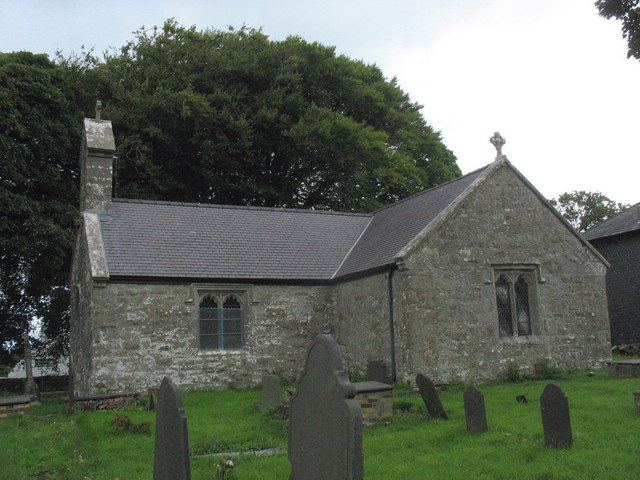
English: Eglwys Gallgo Sant/St Gallgo Church, Llanallgo, near to Llanallgo, Isle of Anglesey/Sir Ynys Mon, Great Britain.
Gallo, who founded this church early in the 6thC, was the son of Caw, a Pictish king, and brother of St Gildas and St Eugrad. Like many other old churches in Anglesey it underwent much restoration in Victorian time. It also became famous in the wake of the Royal Charter disaster of 1859 when 140 of the victims were buried in its churchyard. Charles Dickens visited the area and wrote about the disaster. During his visit Dickens stayed at the rectory with the vicar, the Rev. Stephen Roose Hughes |
| Date | |
| Source | From geograph.org.uk; transferred by User:Bencherlite using geograph_org2commons. |
| Author | Eric Jones |
| Permission (Reusing this file) |
Creative Commons Attribution Share-alike license 2.0 |
| Attribution (required by the license) | Eric Jones / Eglwys Gallgo Sant/St Gallgo Church, Llanallgo / |
| Camera location | | View this and other nearby images on: OpenStreetMap |
|---|
| Object location | | View this and other nearby images on: OpenStreetMap |
|---|
_region:GB-GBN_heading:0.00&language=en)
Licensing

|
This image was taken from the Geograph project collection. See this photograph's page on the Geograph website for the photographer's contact details. The copyright on this image is owned by Eric Jones and is licensed for reuse under the Creative Commons Attribution-ShareAlike 2.0 license.
|
This file is licensed under the Creative Commons Attribution-Share Alike 2.0 Generic license.
Attribution: Eric Jones
- You are free:
- to share – to copy, distribute and transmit the work
- to remix – to adapt the work
- Under the following conditions:
- attribution – You must give appropriate credit, provide a link to the license, and indicate if changes were made. You may do so in any reasonable manner, but not in any way that suggests the licensor endorses you or your use.
- share alike – If you remix, transform, or build upon the material, you must distribute your contributions under the same or compatible license as the original.
File history
Click on a date/time to view the file as it appeared at that time.
| Date/Time | Thumbnail | Dimensions | User | Comment | |
|---|---|---|---|---|---|
| current | 21:53, 16 February 2011 | | 640 × 480 (82 KB) | File Upload Bot (Magnus Manske) |
File usage
The following pages on the English Wikipedia use this file (pages on other projects are not listed):
Global file usage
The following other wikis use this file:
- Usage on arz.wikipedia.org
- Usage on www.wikidata.org