No higher resolution available.
Dybboel-moelle.jpg (694 × 475 pixels, file size: 58 KB, MIME type: image/jpeg)
| This is a file from the Wikimedia Commons. Information from its description page there is shown below. Commons is a freely licensed media file repository. You can help. |
From the German Wikipedia (de:Bild:Dybboel-moelle.jpg)
en:
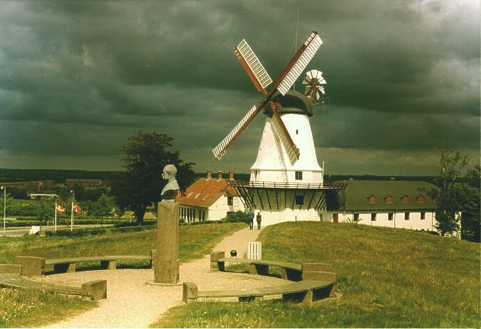
- The Mill near the Dybbøl Trenches, a Danish national memorial. The nearby town of Sønderborg can be seen in the left background.
- Date: 1998
- Photographer: Arne List
da:
- Dybbøl Mølle, et mindesmærke over krigen i 1864. Sønderborg kan ses i baggrunden til venstre.
- Dato: 1998
- Fotograf: Arne List
de:
- Die Mühle an den Düppeler Schanzen, nationale Gedenkstätte in Dänemark. Links im Hintergrund sind Häuserblocks des nahen Sonderburg zu erkennen.
- Aufnahmejahr: 1998
- Fotograf: Arne List

|
Permission is granted to copy, distribute and/or modify this document under the terms of the GNU Free Documentation License, Version 1.2 or any later version published by the Free Software Foundation; with no Invariant Sections, no Front-Cover Texts, and no Back-Cover Texts. A copy of the license is included in the section entitled GNU Free Documentation License. |
| This file is licensed under the Creative Commons Attribution-Share Alike 3.0 Unported license. | ||
| ||
| This licensing tag was added to this file as part of the GFDL licensing update. |
 |
This picture was selected in July and August 2006 for picture of the month at the Portal Denmark at German Wikipedia. |
| Object location | | View this and other nearby images on: OpenStreetMap |
|---|
| Camera location | | View this and other nearby images on: OpenStreetMap |
|---|
File history
Click on a date/time to view the file as it appeared at that time.
| Date/Time | Thumbnail | Dimensions | User | Comment | |
|---|---|---|---|---|---|
| current | 11:12, 12 June 2006 | | 694 × 475 (58 KB) | Valentinian | From the German Wikipedia |
File usage
The following pages on the English Wikipedia use this file (pages on other projects are not listed):
Global file usage
The following other wikis use this file:
- Usage on ast.wikipedia.org
- Usage on da.wikipedia.org
- Usage on de.wikipedia.org
- Usage on es.wikipedia.org
- Usage on fr.wikipedia.org
- Usage on hr.wikipedia.org
- Usage on hy.wikipedia.org
- Usage on is.wikipedia.org
- Usage on it.wikipedia.org
- Usage on no.wikipedia.org
- Usage on ru.wikipedia.org
- Usage on tr.wikipedia.org
- Usage on uk.wikipedia.org
- Usage on vi.wikipedia.org