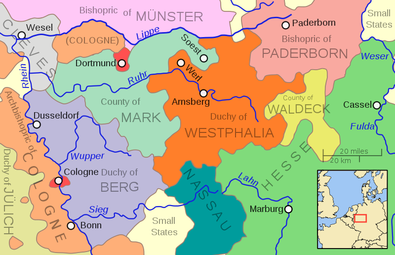
Size of this PNG preview of this SVG file: 800 × 516 pixels. Other resolutions: 320 × 206 pixels | 640 × 413 pixels | 1,024 × 660 pixels | 1,280 × 826 pixels | 2,560 × 1,651 pixels.
Original file (SVG file, nominally 800 × 516 pixels, file size: 176 KB)
File history
Click on a date/time to view the file as it appeared at that time.
| Date/Time | Thumbnail | Dimensions | User | Comment | |
|---|---|---|---|---|---|
| current | 13:44, 6 May 2011 |  | 800 × 516 (176 KB) | Ras67 | valid svg code |
| 03:45, 6 May 2011 |  | 800 × 516 (144 KB) | Ras67 | frame removed, 800px | |
| 04:03, 16 October 2009 |  | 704 × 459 (216 KB) | MapMaster | Needed to change page size to properly reflect enlarged drawing | |
| 21:48, 15 October 2009 |  | 352 × 229 (216 KB) | MapMaster | More river names, strict font usage, twice as large. | |
| 17:42, 15 October 2009 |  | 352 × 229 (208 KB) | MapMaster | {{Information |Description={{en|1=A map showing the Duchy of Westphalia and other eastern German states in the year 1645.}} |Source=Own work |Author=MapMaster |Date=15 October 2009 |Permission= |other_versions= }} [[Category:Maps of th |
File usage
No pages on the English Wikipedia use this file (pages on other projects are not listed).
Global file usage
The following other wikis use this file:
- Usage on bg.wikipedia.org
- Usage on cs.wikipedia.org
- Usage on es.wikipedia.org
- Usage on et.wikipedia.org
- Usage on fr.wikipedia.org
- Usage on it.wikipedia.org
- Usage on ja.wikipedia.org
- Usage on ru.wikipedia.org