
Size of this preview: 800 × 600 pixels. Other resolutions: 320 × 240 pixels | 640 × 480 pixels | 1,024 × 768 pixels | 1,280 × 960 pixels | 2,560 × 1,920 pixels | 4,032 × 3,024 pixels.
Original file (4,032 × 3,024 pixels, file size: 3 MB, MIME type: image/jpeg)
| This is a file from the Wikimedia Commons. Information from its description page there is shown below. Commons is a freely licensed media file repository. You can help. |
Summary
| Description |
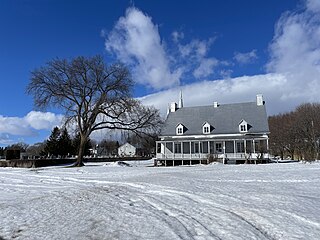
English: Capitale-Nationale, MRC Portneuf, Deschambault-Grondines (Municipality), (Grondines Sector) presbytery of Saint-Charles-des-Grondines, 490, chemin du Roy, Monday, February 12, 2024
Français : Capitale-Nationale, MRC Portneuf, Deschambault-Grondines (Municipalité), (Secteur Grondines) presbytère de Saint-Charles-des-Grondines, 490, chemin du Roy, le lundi 12 février 2024 |
| Date | |
| Source | Own work |
| Author | Nichole Ouellette |
| Camera location | | View this and other nearby images on: OpenStreetMap |
|---|
- More infos/photos, same author: ouellette001.com/florelaurentienne.com
- Québec en photos – Portneuf Rivière du Moulin, Vieux moulin Hamelin (moulin à farine du faubourg) Deschambault-Grondines
- Fleuve Saint-Laurent, battures, chemin des Ancêtres et moulin banal, Deschambault-Grondines
- Arrière-rivage section estuarienne du fleuve Saint-Laurent
- De la décharge du lac Saint-Pierre jusqu’à la MRC de L’Islet Portion du fleuve sous la puissance des marées d’eau douce
- About ouellette001.com
Licensing
I, the copyright holder of this work, hereby publish it under the following license:
This file is licensed under the Creative Commons Attribution 4.0 International license.
- You are free:
- to share – to copy, distribute and transmit the work
- to remix – to adapt the work
- Under the following conditions:
- attribution – You must give appropriate credit, provide a link to the license, and indicate if changes were made. You may do so in any reasonable manner, but not in any way that suggests the licensor endorses you or your use.
File history
Click on a date/time to view the file as it appeared at that time.
| Date/Time | Thumbnail | Dimensions | User | Comment | |
|---|---|---|---|---|---|
| current | 21:34, 12 February 2024 | | 4,032 × 3,024 (3 MB) | Nichole Ouellette | Uploaded own work with UploadWizard |
File usage
The following pages on the English Wikipedia use this file (pages on other projects are not listed):
Global file usage
The following other wikis use this file:
- Usage on fr.wikipedia.org