
Size of this PNG preview of this SVG file: 800 × 444 pixels. Other resolutions: 320 × 178 pixels | 640 × 356 pixels | 1,024 × 569 pixels | 1,280 × 711 pixels | 2,560 × 1,422 pixels | 900 × 500 pixels.
Original file (SVG file, nominally 900 × 500 pixels, file size: 54 KB)
| This is a file from the Wikimedia Commons. Information from its description page there is shown below. Commons is a freely licensed media file repository. You can help. |
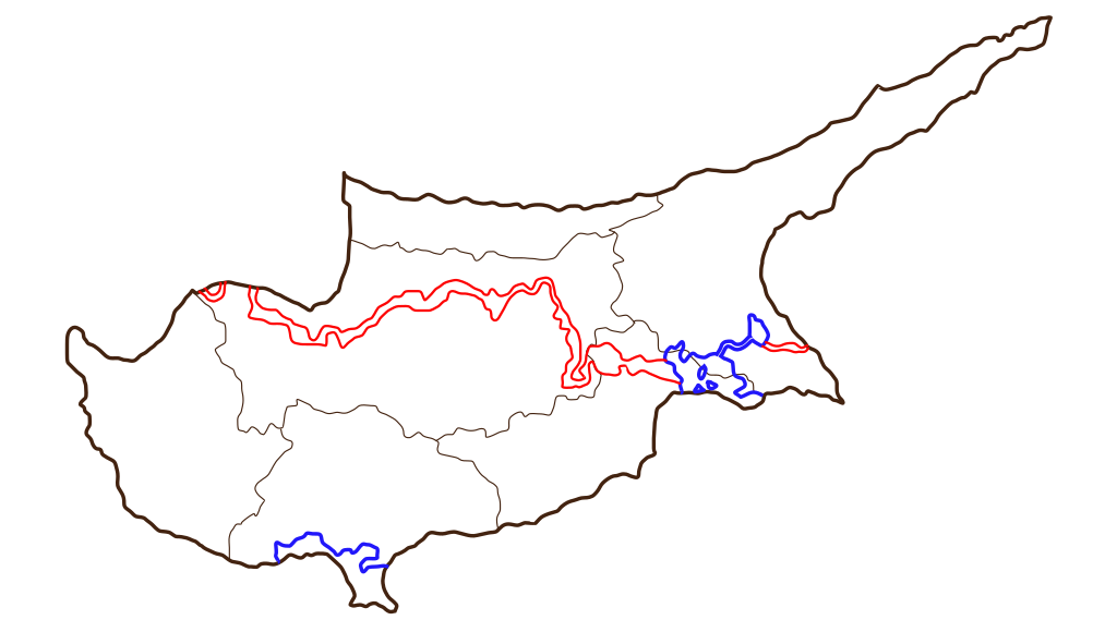
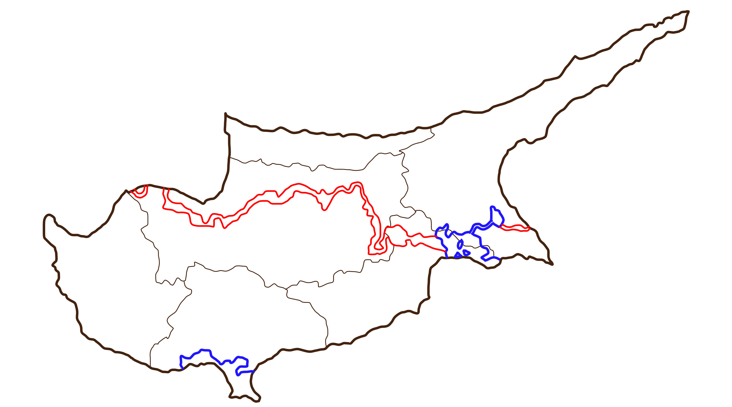
| Description | SVG version of blank map of the districts of Cyprus, including the UN line of control and the British bases; see Image:Cyprus districts only blank.png for a map without those. Original made by User:Golbez, re-drawn in Inkscape by Fut.Perf. |
| Date | (UTC) |
| Source | |
| Author |
|
I, the copyright holder of this work, hereby publish it under the following licenses:
This file is licensed under the Creative Commons Attribution 2.5 Generic license.
- You are free:
- to share – to copy, distribute and transmit the work
- to remix – to adapt the work
- Under the following conditions:
- attribution – You must give appropriate credit, provide a link to the license, and indicate if changes were made. You may do so in any reasonable manner, but not in any way that suggests the licensor endorses you or your use.

|
Permission is granted to copy, distribute and/or modify this document under the terms of the GNU Free Documentation License, Version 1.2 or any later version published by the Free Software Foundation; with no Invariant Sections, no Front-Cover Texts, and no Back-Cover Texts. A copy of the license is included in the section entitled GNU Free Documentation License. |
| This file is licensed under the Creative Commons Attribution-Share Alike 3.0 Unported license. | ||
| ||
| This licensing tag was added to this file as part of the GFDL licensing update. |
You may select the license of your choice.
Original upload log
This image is a derivative work of the following images:
- Image:Cyprus_districts_blank.png licensed with Cc-by-2.5, GFDL
- 2005-12-27T01:08:13Z Golbez 2000x1216 (18617 Bytes) Blank map of the districts of Cyprus, useful for labelling/numbering in other languages. This includes the UN line of control and the British bases; see [[:Image:Cyprus districts only blank.png]] for a map without those. Mad
Uploaded with derivativeFX
File history
Click on a date/time to view the file as it appeared at that time.
| Date/Time | Thumbnail | Dimensions | User | Comment | |
|---|---|---|---|---|---|
| current | 14:41, 7 September 2008 | | 900 × 500 (54 KB) | Future Perfect at Sunrise | {{Information |Description= |Source= |Date= |Author= |Permission= |other_versions= }} |
| 18:06, 6 September 2008 |  | 900 × 500 (54 KB) | Future Perfect at Sunrise | {{Information |Description=SVG version of blank map of the districts of Cyprus, including the UN line of control and the British bases; see Image:Cyprus districts only blank.png for a map without those. Original made by User:Golbez, re-drawn in |
File usage
The following pages on the English Wikipedia use this file (pages on other projects are not listed):
Global file usage
The following other wikis use this file:
- Usage on el.wikipedia.org
- Usage on ru.wikipedia.org