
Size of this PNG preview of this SVG file: 379 × 599 pixels. Other resolutions: 152 × 240 pixels | 304 × 480 pixels | 486 × 768 pixels | 648 × 1,024 pixels | 1,296 × 2,048 pixels | 1,778 × 2,810 pixels.
Original file (SVG file, nominally 1,778 × 2,810 pixels, file size: 116 KB)
| This is a file from the Wikimedia Commons. Information from its description page there is shown below. Commons is a freely licensed media file repository. You can help. |
Summary
| Description |
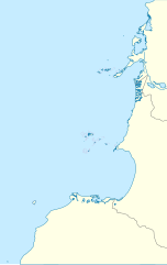
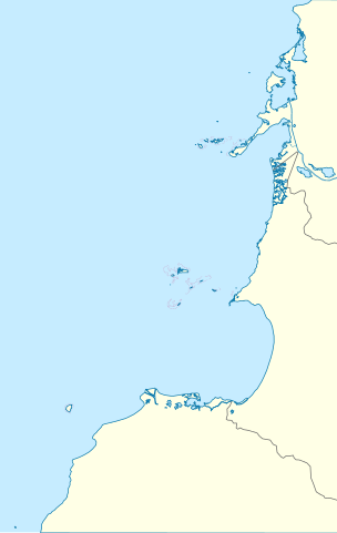
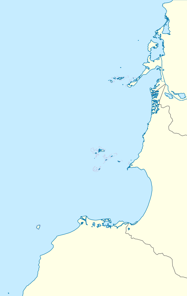
English: Location map of Caribbean coastal islands of Colombia.
Geographic limits of the map:
Español: Mapa localizador de las islas costeras del Caribe colombiano (Islas Corales del Rosario, Archipiélago de San Bernardo, Isla Fuerte e Isla Tortuguilla) |
| Date | |
| Source | Own work |
| Author | Milenioscuro |
Licensing
I, the copyright holder of this work, hereby publish it under the following license:
This file is licensed under the Creative Commons Attribution-Share Alike 3.0 Unported license.
- You are free:
- to share – to copy, distribute and transmit the work
- to remix – to adapt the work
- Under the following conditions:
- attribution – You must give appropriate credit, provide a link to the license, and indicate if changes were made. You may do so in any reasonable manner, but not in any way that suggests the licensor endorses you or your use.
- share alike – If you remix, transform, or build upon the material, you must distribute your contributions under the same or compatible license as the original.
File history
Click on a date/time to view the file as it appeared at that time.
| Date/Time | Thumbnail | Dimensions | User | Comment | |
|---|---|---|---|---|---|
| current | 08:33, 26 May 2015 | | 1,778 × 2,810 (116 KB) | Milenioscuro | border |
| 00:24, 27 December 2011 |  | 1,778 × 2,810 (117 KB) | Milenioscuro | layers, borders, and other changes | |
| 18:36, 12 August 2011 |  | 1,778 × 2,810 (143 KB) | Milenioscuro | colors | |
| 07:43, 9 July 2011 |  | 1,778 × 2,810 (168 KB) | Milenioscuro | {{Information |Description ={{en|1=Location map of Caribbean coastal islands of Colombia.}} {{es|1=Mapa localizador de las islas costeras del Caribe colombiano (Islas Corales del Rosario, [[:es:Archipiélago de San Ber |
File usage
The following pages on the English Wikipedia use this file (pages on other projects are not listed):
Global file usage
The following other wikis use this file:
- Usage on de.wikipedia.org
- Usage on es.wikipedia.org
- Usage on fa.wikipedia.org
- Usage on fr.wikipedia.org
- Usage on nl.wikipedia.org
- Usage on si.wikipedia.org
- Usage on uz.wikipedia.org