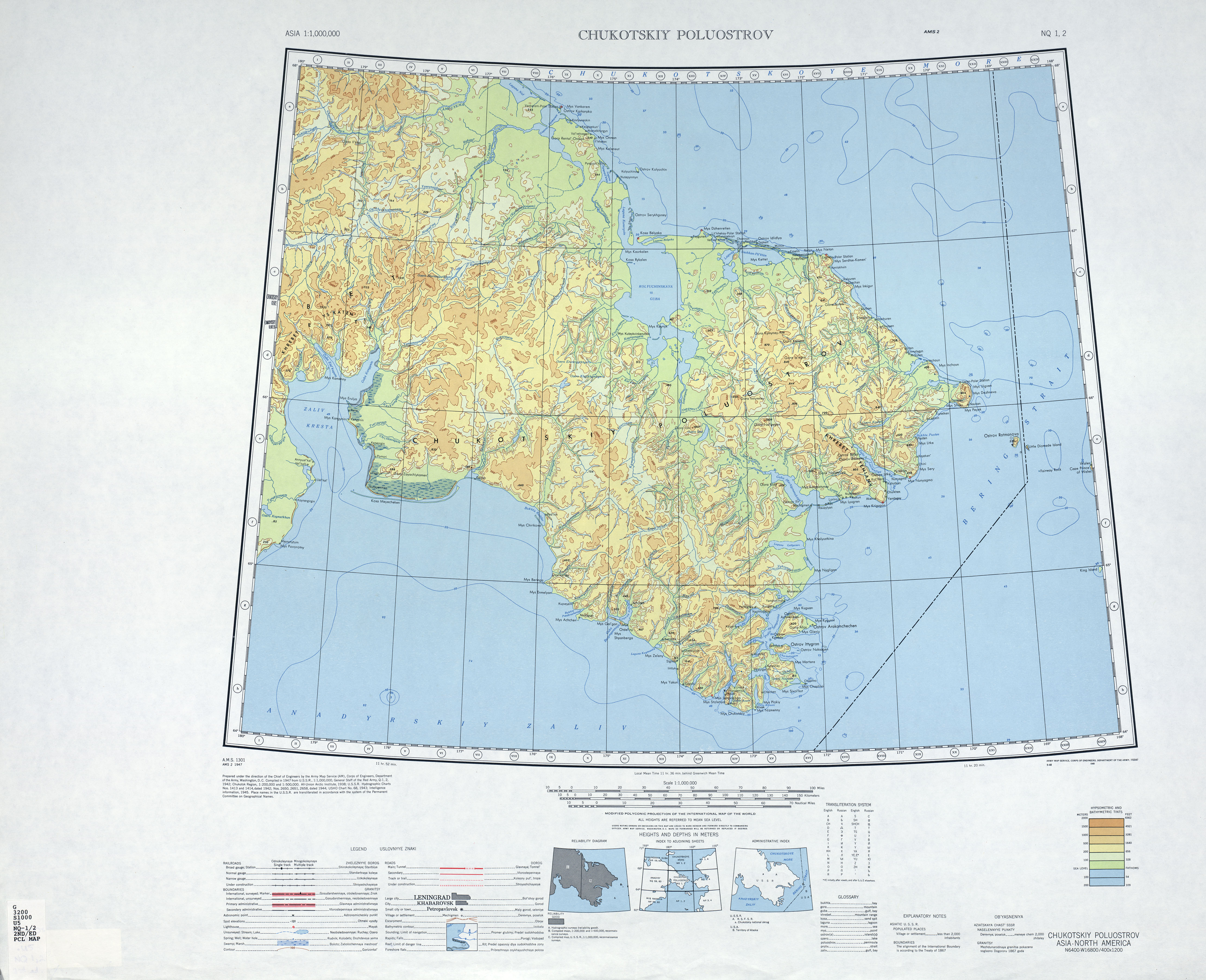
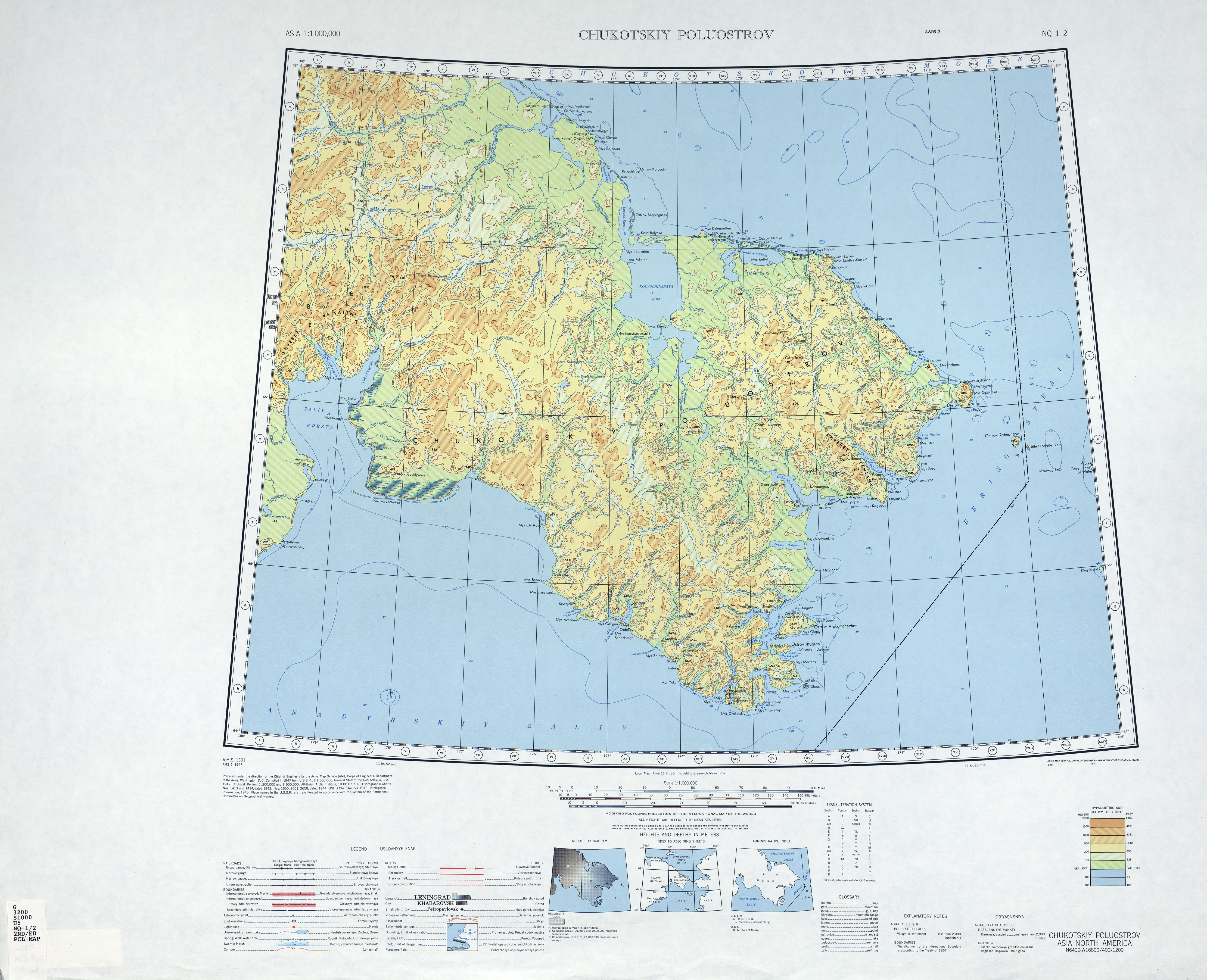
Size of this preview: 738 × 599 pixels. Other resolutions: 296 × 240 pixels | 591 × 480 pixels | 946 × 768 pixels | 1,261 × 1,024 pixels | 2,522 × 2,048 pixels | 4,440 × 3,606 pixels.
Original file (4,440 × 3,606 pixels, file size: 3.42 MB, MIME type: image/jpeg)
| This is a file from the Wikimedia Commons. Information from its description page there is shown below. Commons is a freely licensed media file repository. You can help. |
Summary
| Description |
English: map of Chukchi peninsula, Russian Far East |
| Date | |
| Source | http://www.lib.utexas.edu/maps/imw/txu-oclc-6654394-nq-1-2-2nd-ed.jpg |
| Author | Army Map Service |
Licensing
This file is a work of a U.S. Army soldier or employee, taken or made as part of that person's official duties. As a work of the U.S. federal government, it is in the public domain in the United States.
|
 |
File history
Click on a date/time to view the file as it appeared at that time.
| Date/Time | Thumbnail | Dimensions | User | Comment | |
|---|---|---|---|---|---|
| current | 21:22, 4 April 2010 | | 4,440 × 3,606 (3.42 MB) | Ratzer | {{Information |Description={{en|1=map of Chukchi peninsula, Russian Far East}} |Source=http://www.lib.utexas.edu/maps/imw/txu-oclc-6654394-nq-1-2-2nd-ed.jpg |Author=Army Map Service |Date=1947 |Permission= |other_versions= }} Category:Maps of Siberia |
File usage
The following pages on the English Wikipedia use this file (pages on other projects are not listed):
Global file usage
The following other wikis use this file:
- Usage on ar.wikipedia.org
- Usage on az.wikipedia.org
- Usage on ba.wikipedia.org
- Usage on cs.wikipedia.org
- Usage on de.wikipedia.org
- Usage on es.wikipedia.org
- Usage on et.wikipedia.org
- Usage on he.wikipedia.org
- Usage on hr.wikipedia.org
- Usage on hsb.wikipedia.org
- Usage on hy.wikipedia.org
- Usage on ml.wikipedia.org
- Usage on sr.wikipedia.org
- Usage on sw.wikipedia.org
- Usage on ta.wikipedia.org
- Usage on uk.wikipedia.org