Size of this preview: 666 × 600 pixels. Other resolutions: 267 × 240 pixels | 533 × 480 pixels | 674 × 607 pixels.
Original file (674 × 607 pixels, file size: 83 KB, MIME type: image/png)
File history
Click on a date/time to view the file as it appeared at that time.
| Date/Time | Thumbnail | Dimensions | User | Comment | |
|---|---|---|---|---|---|
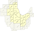
| current | 21:48, 18 August 2009 |  | 674 × 607 (83 KB) | Isipeoria | {{Information |Description = Map of the 16-county region of the Chicago CSA. |Source = I (~~~) created this work entirely by myself. County maps derived from state/county maps of Illinois, Indiana, Wisconsin, and Michigan from Wikipedia. |Da |
File usage
The following pages on the English Wikipedia use this file (pages on other projects are not listed):