No higher resolution available.
Chapel_of_Ease,_Tregaminion_-_geograph.org.uk_-_187238.jpg (640 × 480 pixels, file size: 148 KB, MIME type: image/jpeg)
| This is a file from the Wikimedia Commons. Information from its description page there is shown below. Commons is a freely licensed media file repository. You can help. |
Summary
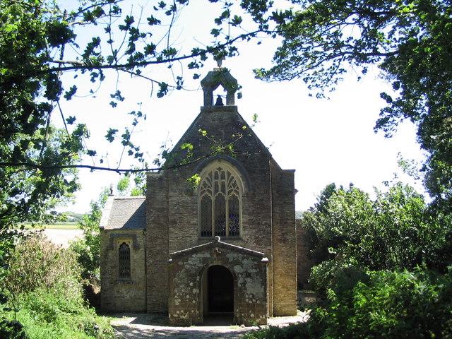
| Description |
English: Chapel of Ease, Tregaminion. The 'Saints' Way' passes this chapel. The Way is a convenient shortcut of Gribbin Head for walkers of the South West Coast Path wishing to broaden the rather one-dimensional views offered by the coastal path
|
|
| Date | ||
| Source | From geograph.org.uk | |
| Author | Tim Heaton | |
| Attribution (required by the license) | Tim Heaton / Chapel of Ease, Tregaminion / | |
| Camera location | | View this and other nearby images on: OpenStreetMap |
|---|
_heading:90.00&language=en)
| Object location | | View this and other nearby images on: OpenStreetMap |
|---|
_heading:90.00&language=en)
Licensing

|
This image was taken from the Geograph project collection. See this photograph's page on the Geograph website for the photographer's contact details. The copyright on this image is owned by Tim Heaton and is licensed for reuse under the Creative Commons Attribution-ShareAlike 2.0 license.
|
This file is licensed under the Creative Commons Attribution-Share Alike 2.0 Generic license.
Attribution: Tim Heaton
- You are free:
- to share – to copy, distribute and transmit the work
- to remix – to adapt the work
- Under the following conditions:
- attribution – You must give appropriate credit, provide a link to the license, and indicate if changes were made. You may do so in any reasonable manner, but not in any way that suggests the licensor endorses you or your use.
- share alike – If you remix, transform, or build upon the material, you must distribute your contributions under the same or compatible license as the original.
File history
Click on a date/time to view the file as it appeared at that time.
| Date/Time | Thumbnail | Dimensions | User | Comment | |
|---|---|---|---|---|---|
| current | 15:24, 31 January 2010 | | 640 × 480 (148 KB) | GeographBot | == {{int:filedesc}} == {{Information |description={{en|1=Chapel of Ease, Tregaminion. The 'Saints' Way' passes this chapel. The Way is a convenient shortcut of Gribbin Head for walkers of the South West Coast Path wishing to broaden the rather one-dimensi |
File usage
The following pages on the English Wikipedia use this file (pages on other projects are not listed):
Global file usage
The following other wikis use this file:
- Usage on dag.wikipedia.org
- Usage on www.wikidata.org