
Size of this preview: 736 × 600 pixels. Other resolutions: 295 × 240 pixels | 589 × 480 pixels | 757 × 617 pixels.
Original file (757 × 617 pixels, file size: 91 KB, MIME type: image/jpeg)
| This is a file from the Wikimedia Commons. Information from its description page there is shown below. Commons is a freely licensed media file repository. You can help. |
Summary
| Description |
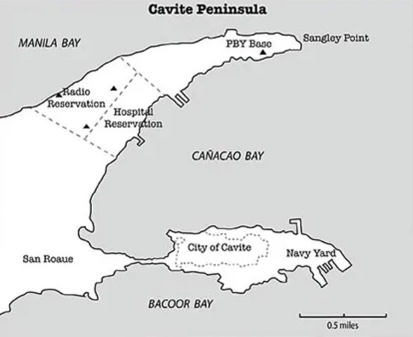
English: US Navy map of Cavite Peninsula with Naval Base Manila in 1941. Naval Station Sangley Point top and Naval Base Cavite lower. |
| Date | |
| Source | https://expendable.us/maps-and-photos/ |
| Author | US Navy |
Licensing
This file is a work of a sailor or employee of the U.S. Navy, taken or made as part of that person's official duties. As a work of the U.S. federal government, it is in the public domain in the United States.
|
 | |
| This file has been identified as being free of known restrictions under copyright law, including all related and neighboring rights. | ||
File history
Click on a date/time to view the file as it appeared at that time.
| Date/Time | Thumbnail | Dimensions | User | Comment | |
|---|---|---|---|---|---|
| current | 20:51, 29 August 2022 | | 757 × 617 (91 KB) | Telecineguy | Uploading a public-domain item using File Upload Wizard |
File usage
The following pages on the English Wikipedia use this file (pages on other projects are not listed):