Size of this preview: 450 × 600 pixels. Other resolutions: 180 × 240 pixels | 480 × 640 pixels.
Original file (480 × 640 pixels, file size: 110 KB, MIME type: image/jpeg)
| This is a file from the Wikimedia Commons. Information from its description page there is shown below. Commons is a freely licensed media file repository. You can help. |
Summary
| Description |
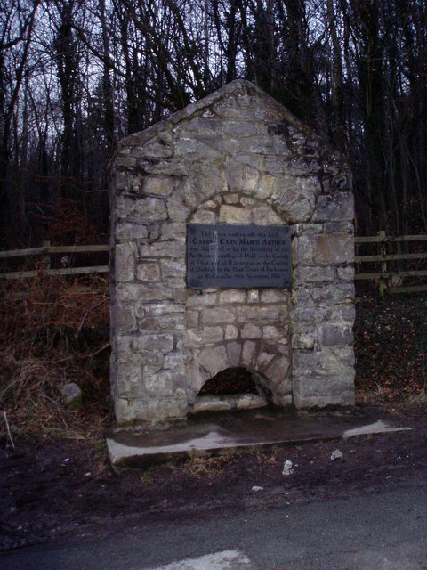
English: Carreg Carn March Arthur. The plaque reads "The stone underneath this Arch Carreg Carn March Arthur was Adjudged to be the Boundary of the Parish and Lordship of Mold in the county of Flint and of Llanverres in the County of Denbigh by the High Court of Exchequer at Westminster 10th November 1763". Legend has it that the stone bears the hoofprint of King Arthur's horse as he leapt from a nearby cliff to escape the invading Saxons. |
| Date | |
| Source | From geograph.org.uk |
| Author | Eirian Evans |
| Attribution (required by the license) | Eirian Evans / Carreg Carn March Arthur / |
| Object location | | View this and other nearby images on: OpenStreetMap |
|---|
_&language=en)
Licensing

|
This image was taken from the Geograph project collection. See this photograph's page on the Geograph website for the photographer's contact details. The copyright on this image is owned by Eirian Evans and is licensed for reuse under the Creative Commons Attribution-ShareAlike 2.0 license.
|
This file is licensed under the Creative Commons Attribution-Share Alike 2.0 Generic license.
Attribution: Eirian Evans
- You are free:
- to share – to copy, distribute and transmit the work
- to remix – to adapt the work
- Under the following conditions:
- attribution – You must give appropriate credit, provide a link to the license, and indicate if changes were made. You may do so in any reasonable manner, but not in any way that suggests the licensor endorses you or your use.
- share alike – If you remix, transform, or build upon the material, you must distribute your contributions under the same or compatible license as the original.
File history
Click on a date/time to view the file as it appeared at that time.
| Date/Time | Thumbnail | Dimensions | User | Comment | |
|---|---|---|---|---|---|
| current | 03:31, 31 January 2010 | | 480 × 640 (110 KB) | GeographBot | == {{int:filedesc}} == {{Information |description={{en|1=Carreg Carn March Arthur. The plaque reads "The stone underneath this Arch Carreg Carn March Arthur was Adjudged to be the Boundary of the Parish and Lordship of Mold in the county of Flint and of L |
File usage
The following pages on the English Wikipedia use this file (pages on other projects are not listed):