
Size of this PNG preview of this SVG file: 741 × 600 pixels. Other resolutions: 297 × 240 pixels | 593 × 480 pixels | 949 × 768 pixels | 1,265 × 1,024 pixels | 2,531 × 2,048 pixels | 755 × 611 pixels.
Original file (SVG file, nominally 755 × 611 pixels, file size: 2.12 MB)
| This is a file from the Wikimedia Commons. Information from its description page there is shown below. Commons is a freely licensed media file repository. You can help. |
Summary
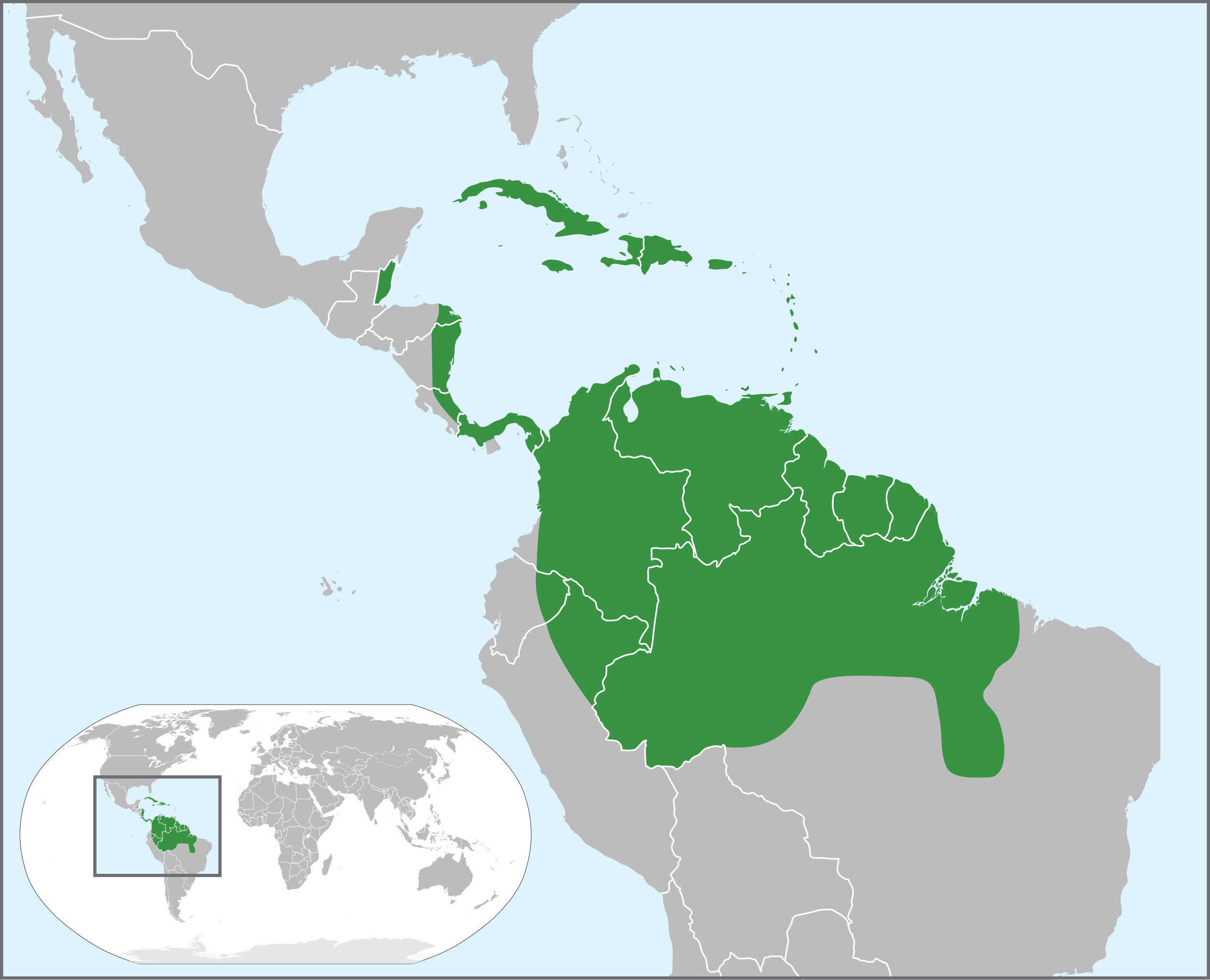
| Description | World distribution of Carapa guianensis trees. |
| Date | (UTC) |
| Source |
This file was derived from: BlankMap-World.svg:
|
| Author |
|
| This is a retouched picture, which means that it has been digitally altered from its original version. Modifications: coloured to show world distribution of Carapa guianensis trees.. The original can be viewed here: BlankMap-World.svg:
|
Licensing
I, the copyright holder of this work, hereby publish it under the following license:
| I, the copyright holder of this work, release this work into the public domain. This applies worldwide. In some countries this may not be legally possible; if so: I grant anyone the right to use this work for any purpose, without any conditions, unless such conditions are required by law. |
Original upload log
This image is a derivative work of the following images:
- File:BlankMap-World7.svg licensed with PD-self
- 2007-01-09T03:50:03Z Roke 940x477 (2549763 Bytes) Based on [[:Image:BlankMap-World6.svg]] {{PD-self}}
Uploaded with derivativeFX
File history
Click on a date/time to view the file as it appeared at that time.
| Date/Time | Thumbnail | Dimensions | User | Comment | |
|---|---|---|---|---|---|
| current | 13:00, 10 October 2013 | | 755 × 611 (2.12 MB) | Begoon | tweak a couple of paths |
| 12:08, 10 October 2013 |  | 755 × 611 (2.15 MB) | Begoon | remove a couple of Panama islands from coloured extent | |
| 06:43, 10 October 2013 |  | 755 × 611 (2.15 MB) | Begoon | no changes - just rationalising groups/layers | |
| 04:50, 10 October 2013 |  | 755 × 611 (2 MB) | Begoon | oops - wrong layer order for key outline... | |
| 04:44, 10 October 2013 |  | 755 × 611 (2 MB) | Begoon | inset should duplicate what it shows... | |
| 04:08, 10 October 2013 |  | 755 × 611 (2 MB) | Begoon | eh... - missed some "frilly bits". Slartibartfast would be appalled... | |
| 03:53, 10 October 2013 |  | 755 × 611 (2 MB) | Begoon | with inset colour | |
| 03:32, 10 October 2013 |  | 755 × 611 (4.77 MB) | Begoon | ok - back soon... | |
| 03:30, 10 October 2013 |  | 755 × 611 (1.92 MB) | Begoon | test recoloured extents - inset still needs colour | |
| 02:12, 9 October 2013 |  | 755 × 611 (4.77 MB) | Begoon | meh - that was pretty broken - try this, which will need optimising later... |
File usage
The following pages on the English Wikipedia use this file (pages on other projects are not listed):
Global file usage
The following other wikis use this file:
- Usage on arz.wikipedia.org
- Usage on ast.wikipedia.org
- Usage on es.wikipedia.org
- Usage on fr.wikipedia.org
- Usage on hy.wikipedia.org
- Usage on it.wikipedia.org
- Usage on nl.wikipedia.org
- Usage on pt.wikipedia.org
- Usage on sv.wikipedia.org
- Usage on www.wikidata.org