Size of this preview: 756 × 599 pixels. Other resolutions: 303 × 240 pixels | 606 × 480 pixels | 969 × 768 pixels | 1,280 × 1,015 pixels | 2,064 × 1,636 pixels.
Original file (2,064 × 1,636 pixels, file size: 1.14 MB, MIME type: image/jpeg)
| This is a file from the Wikimedia Commons. Information from its description page there is shown below. Commons is a freely licensed media file repository. You can help. |
Summary
| Description |
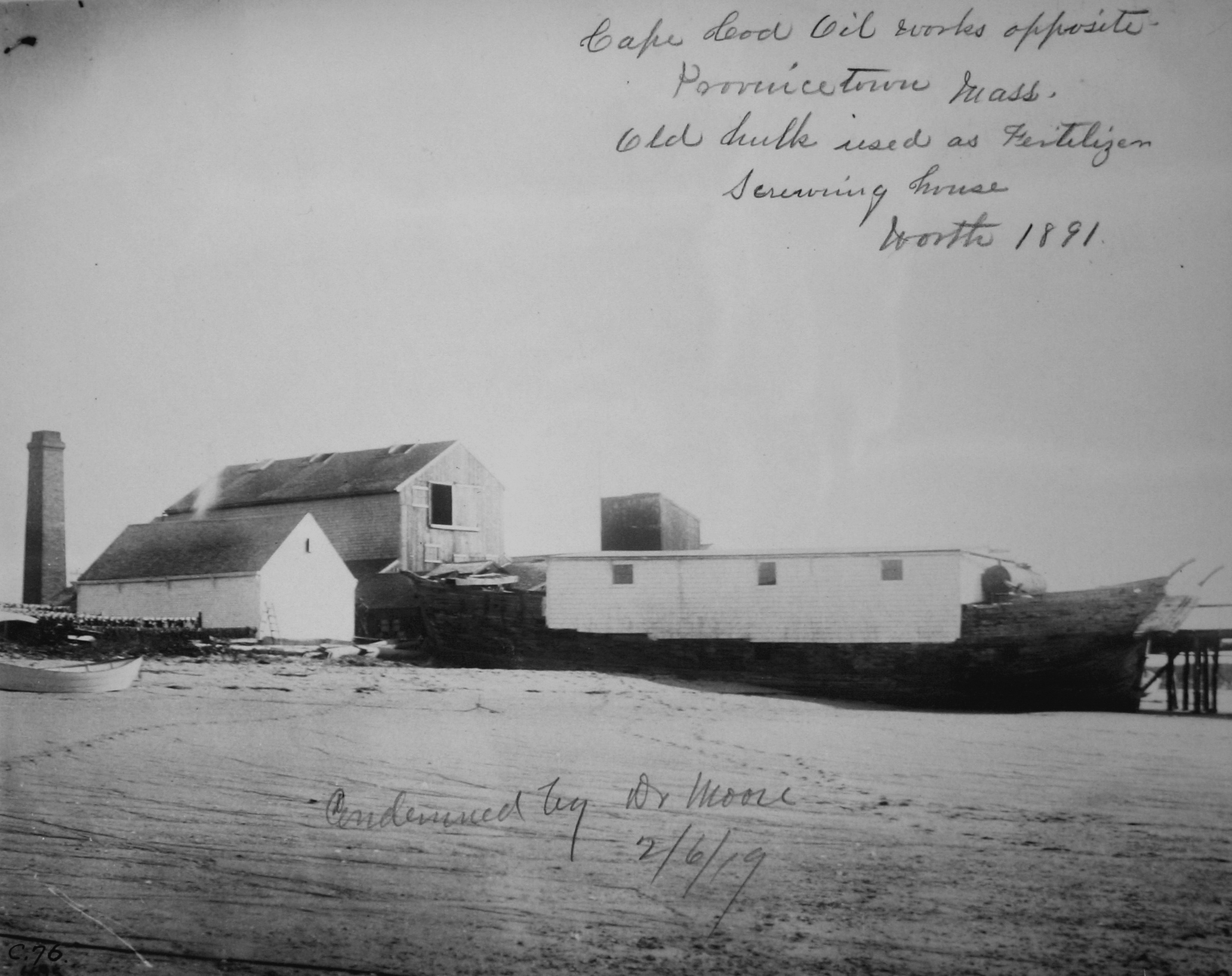
English: Written on this photograph is the following inscription:
Bottom inscription (added later) reads:
|
| Date | |
| Source | NOAA's Historic Fisheries Collection, http://www.photolib.noaa.gov/htmls/fish6914.htm |
| Author | Archival Photographer Stefan Claesson |
| Camera location | | View this and other nearby images on: OpenStreetMap |
|---|
The Cape Cod Oil Works was built on Long Point after the U.S. military ceased occupation of the artillery batteries. The following is excerpted from Long Point (Cape Cod):
- "Even though the Army had moved out, they retained title to the land. Nevertheless, at around the same time that the lighthouse was rebuilt, the Cape Cod Oil Works built a cod fish oil and whale oil factory in the area that had been the barracks. As the land was still a military reservation, the Army tried to have the factory removed a number of times in the ensuing years. Records from this period are scarce, but Army archives indicate that the factory was still operating in 1883. Another source from 1890 says, 'John Atwood built a wharf on the north side of the point, which is standing to-day, used by the Cape Cod Oil Works, the only buildings now left excepting the lighthouse.' The exact date of the factory's closing is unknown, but official Army correspondence in 1917 makes no mention of it."
Licensing
This image is in the public domain because it contains materials that originally came from the U.S. National Oceanic and Atmospheric Administration, taken or made as part of an employee's official duties.
|
|
This work is in the public domain in its country of origin and other countries and areas where the copyright term is the author's life plus 100 years or fewer. | |
| This file has been identified as being free of known restrictions under copyright law, including all related and neighboring rights. | |
File history
Click on a date/time to view the file as it appeared at that time.
| Date/Time | Thumbnail | Dimensions | User | Comment | |
|---|---|---|---|---|---|
| current | 04:58, 1 December 2012 | | 2,064 × 1,636 (1.14 MB) | Grolltech | User created page with UploadWizard |
File usage
The following pages on the English Wikipedia use this file (pages on other projects are not listed):