Size of this preview: 800 × 587 pixels. Other resolutions: 320 × 235 pixels | 640 × 470 pixels | 1,031 × 757 pixels.
Original file (1,031 × 757 pixels, file size: 1 MB, MIME type: image/png)
| This is a file from the Wikimedia Commons. Information from its description page there is shown below. Commons is a freely licensed media file repository. You can help. |
Summary
| Description |
|
||
| Date | |||
| Source | |||
| Author | Yavidaxiu | ||
| Permission (Reusing this file) |
|
File history
Click on a date/time to view the file as it appeared at that time.
| Date/Time | Thumbnail | Dimensions | User | Comment | |
|---|---|---|---|---|---|
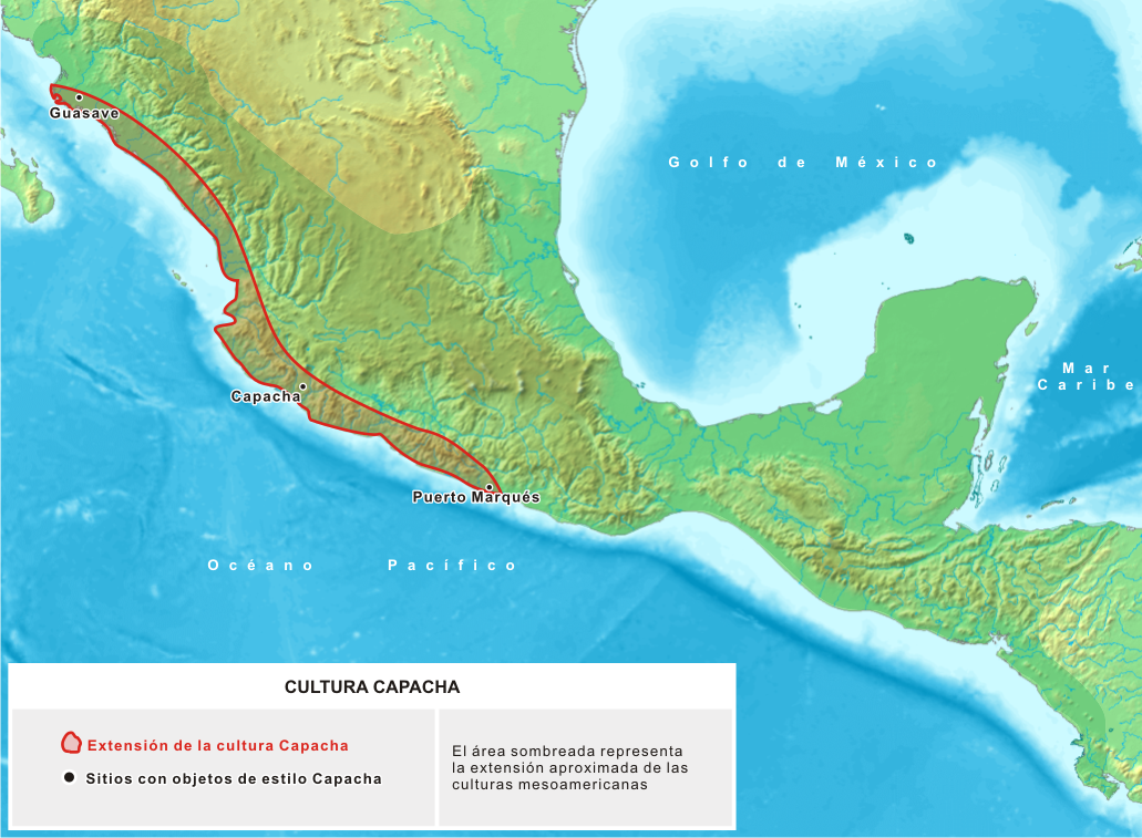
| current | 17:21, 25 November 2006 | | 1,031 × 757 (1 MB) | Yavidaxiu | {{Information |Description={{es|Extensión aproximada de los pueblos mesoamericanos que produjeron cerámica de estilo Capacha, en el Período Preclásico.}} |Source=Trabajo propio, basado en cartografía de User:Koba-chan |Date=23 de noviembre de 2006 |A |
| 21:09, 16 April 2006 |  | 1,074 × 789 (1.19 MB) | Yavidaxiu | Mapa de localización de la cultura Capacha, desarrollada en Mesoamérica en el Período Preclásico Teprano. Category:Maps of México |
File usage
The following pages on the English Wikipedia use this file (pages on other projects are not listed):
Global file usage
The following other wikis use this file:
- Usage on be.wikipedia.org
- Usage on es.wikipedia.org
- Usage on fr.wikipedia.org
- Usage on ka.wikipedia.org
- Usage on pt.wikipedia.org
- Usage on ru.wikipedia.org
- Usage on uk.wikipedia.org