
Size of this PNG preview of this SVG file: 800 × 474 pixels. Other resolutions: 320 × 190 pixels | 640 × 379 pixels | 1,024 × 607 pixels | 1,280 × 759 pixels | 2,560 × 1,518 pixels | 5,137 × 3,046 pixels.
Original file (SVG file, nominally 5,137 × 3,046 pixels, file size: 693 KB)
| This is a file from the Wikimedia Commons. Information from its description page there is shown below. Commons is a freely licensed media file repository. You can help. |
Summary
| Description |
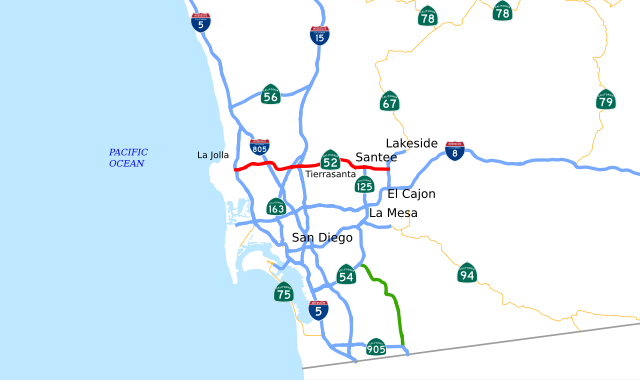
English: This is a map of State Route 52 in California, created in w:Quantum GIS. |
| Date | |
| Source | NHPN, California State GIS |
| Author | User:Rschen7754 |
Licensing
I, the copyright holder of this work, hereby publish it under the following license:
This file is licensed under the Creative Commons Attribution-Share Alike 3.0 Unported license.
- You are free:
- to share – to copy, distribute and transmit the work
- to remix – to adapt the work
- Under the following conditions:
- attribution – You must give appropriate credit, provide a link to the license, and indicate if changes were made. You may do so in any reasonable manner, but not in any way that suggests the licensor endorses you or your use.
- share alike – If you remix, transform, or build upon the material, you must distribute your contributions under the same or compatible license as the original.
File history
Click on a date/time to view the file as it appeared at that time.
| Date/Time | Thumbnail | Dimensions | User | Comment | |
|---|---|---|---|---|---|
| current | 03:15, 1 October 2012 | | 5,137 × 3,046 (693 KB) | Rschen7754 | text bigger |
| 03:05, 1 October 2012 |  | 5,137 × 3,046 (670 KB) | Rschen7754 | text to path | |
| 03:04, 1 October 2012 |  | 5,137 × 3,046 (632 KB) | Rschen7754 | labels galore (using shields from Commons) | |
| 02:47, 1 October 2012 |  | 5,137 × 3,046 (525 KB) | Rschen7754 | make larger | |
| 02:45, 1 October 2012 |  | 5,137 × 3,046 (525 KB) | Rschen7754 | one shield | |
| 02:34, 1 October 2012 |  | 5,137 × 3,046 (431 KB) | Rschen7754 | reduce file size | |
| 01:14, 1 October 2012 |  | 1,027 × 609 (438 KB) | Rschen7754 | fix 2 | |
| 01:07, 1 October 2012 |  | 290 × 172 (437 KB) | Rschen7754 | fix | |
| 01:05, 1 October 2012 | 2,890 × 172 (437 KB) | Rschen7754 | update for extension | ||
| 17:44, 18 December 2007 |  | 1,152 × 640 (67 KB) | NE2 | == Summary == This is a map of State Route 52 in California, with unconstructed parts in purple. Email me if you would like a copy of the GIS data I created for the highways. Category:California State Route 52 [[Category:Map |
File usage
No pages on the English Wikipedia use this file (pages on other projects are not listed).
Global file usage
The following other wikis use this file:
- Usage on de.wikipedia.org
- Usage on es.wikipedia.org
- Usage on fr.wikipedia.org
- Usage on www.wikidata.org
- Usage on zh-min-nan.wikipedia.org
- Usage on zh.wikipedia.org