
Size of this preview: 596 × 600 pixels. Other resolutions: 238 × 240 pixels | 477 × 480 pixels | 763 × 768 pixels | 1,017 × 1,024 pixels | 2,035 × 2,048 pixels | 3,040 × 3,060 pixels.
Original file (3,040 × 3,060 pixels, file size: 1.98 MB, MIME type: image/jpeg)
| This is a file from the Wikimedia Commons. Information from its description page there is shown below. Commons is a freely licensed media file repository. You can help. |
Summary
| Description |
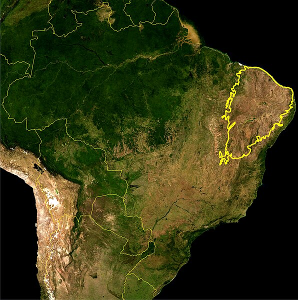
English: This is a map location of the Caatinga Scrub. The yellow line encloses Caatinga scrub as delineated by the IBAMA. I, Miguelrangeljr, made it using NASA Blue Marble imagery and Corel Draw X4 and Photoshop CS5.
Português: Este mapa mostra a localização do bioma da Caatinga. A linha amarela grossa delimita esse bioma como definida pelo IBAMA. Eu,Miguelrangeljr, fiz isso usando uma mapa de satélite da NASA e me baseei no relatório do Desmatamento da Caatinga realizado pelo IBAMA, nos anos de 2002-2008. Para desenhar a linha, foi usado o Corel Draw X4 e o Adobe Photoshop CS5. |
|||||
| Date | ||||||
| Source | NASA plus my editions by myself | |||||
| Author | NASA and Miguelrangeljr | |||||
| Permission (Reusing this file) |
|
Licensing
| This file is in the public domain in the United States because it was solely created by NASA. NASA copyright policy states that "NASA material is not protected by copyright unless noted". (See Template:PD-USGov, NASA copyright policy page or JPL Image Use Policy.) | ||
 |
Warnings:
|
File history
Click on a date/time to view the file as it appeared at that time.
| Date/Time | Thumbnail | Dimensions | User | Comment | |
|---|---|---|---|---|---|
| current | 03:15, 25 July 2012 | | 3,040 × 3,060 (1.98 MB) | Miguelrangeljr | {{Information |Description ={{en|1=This is a map location of the Caatinga Scrub. The yellow line encloses Caatinga scrub as delineated by the IBAMA. I, Miguelrangeljr, made it using NASA Blue Marble imagery and Corel Draw X4 and Photosho... |
File usage
No pages on the English Wikipedia use this file (pages on other projects are not listed).
Global file usage
The following other wikis use this file:
- Usage on bg.wikipedia.org
- Usage on es.wikipedia.org
- Usage on et.wikipedia.org
- Usage on gn.wikipedia.org
- Usage on ml.wikipedia.org
- Usage on ne.wikipedia.org
- Usage on pt.wikipedia.org
- Usage on ru.wikipedia.org
- Usage on sv.wikipedia.org
- Usage on tt.wikipedia.org
- Usage on uk.wikipedia.org