No higher resolution available.
CARICOM_Map_2010-2.png (800 × 406 pixels, file size: 46 KB, MIME type: image/png)
| This is a file from the Wikimedia Commons. Information from its description page there is shown below. Commons is a freely licensed media file repository. You can help. |
| Description |
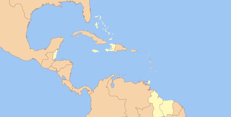
English: A map of the former West Indies Federation.
Map of CARICOM member States. |
| Date | (UTC) |
| Source | |
| Author |
|
| Other versions |
.png)
| This is a retouched picture, which means that it has been digitally altered from its original version. The original can be viewed here: Map of the West Indies Federation.svg:
|
I, the copyright holder of this work, hereby publish it under the following licenses:
This file is licensed under the Creative Commons Attribution-Share Alike 3.0 Unported license.
- You are free:
- to share – to copy, distribute and transmit the work
- to remix – to adapt the work
- Under the following conditions:
- attribution – You must give appropriate credit, provide a link to the license, and indicate if changes were made. You may do so in any reasonable manner, but not in any way that suggests the licensor endorses you or your use.
- share alike – If you remix, transform, or build upon the material, you must distribute your contributions under the same or compatible license as the original.

|
Permission is granted to copy, distribute and/or modify this document under the terms of the GNU Free Documentation License, Version 1.2 or any later version published by the Free Software Foundation; with no Invariant Sections, no Front-Cover Texts, and no Back-Cover Texts. A copy of the license is included in the section entitled GNU Free Documentation License. |
You may select the license of your choice.
Original upload log
This image is a derivative work of the following images:
- File:Map_of_the_West_Indies_Federation.svg licensed with Cc-by-sa-3.0, GFDL
- 2009-09-22T00:24:49Z NuclearVacuum 940x477 (278412 Bytes) glitch
- 2009-09-22T00:04:02Z NuclearVacuum 940x477 (278412 Bytes) new version with wiki-approved colors
- 2009-09-02T17:02:13Z NuclearVacuum 990x765 (285537 Bytes) {{Information |Description={{en|1=A map of the former [[:en:West Indies Federation|]].}} |Source={{Inkscape}} |Author=[[User:NuclearVacuum|NuclearVacuum]] |Date=2009-09-02 |Permission= |other_versions= }} [[Category:User:Nuc
Uploaded with derivativeFX
File history
Click on a date/time to view the file as it appeared at that time.
| Date/Time | Thumbnail | Dimensions | User | Comment | |
|---|---|---|---|---|---|
| current | 15:29, 1 September 2010 | | 800 × 406 (46 KB) | Uniongreen113 | {{Information |Description={{en|1=A map of the former West Indies Federation.}} Map of CARICOM member States. |Source=*File:Map_of_the_West_Indies_Federation.svg |Date=2010-09-01 15:25 (UTC) |Author=*[[:File:Map_of_the |
File usage
No pages on the English Wikipedia use this file (pages on other projects are not listed).
Global file usage
The following other wikis use this file:
- Usage on ba.wikipedia.org
- Usage on cs.wikipedia.org
- Usage on ru.wikipedia.org
- Usage on tr.wikipedia.org