Size of this preview: 787 × 600 pixels. Other resolutions: 315 × 240 pixels | 630 × 480 pixels | 1,008 × 768 pixels | 1,280 × 975 pixels | 2,560 × 1,950 pixels | 4,271 × 3,254 pixels.
Original file (4,271 × 3,254 pixels, file size: 1.1 MB, MIME type: image/jpeg)
| This is a file from the Wikimedia Commons. Information from its description page there is shown below. Commons is a freely licensed media file repository. You can help. |
Summary
| Description |
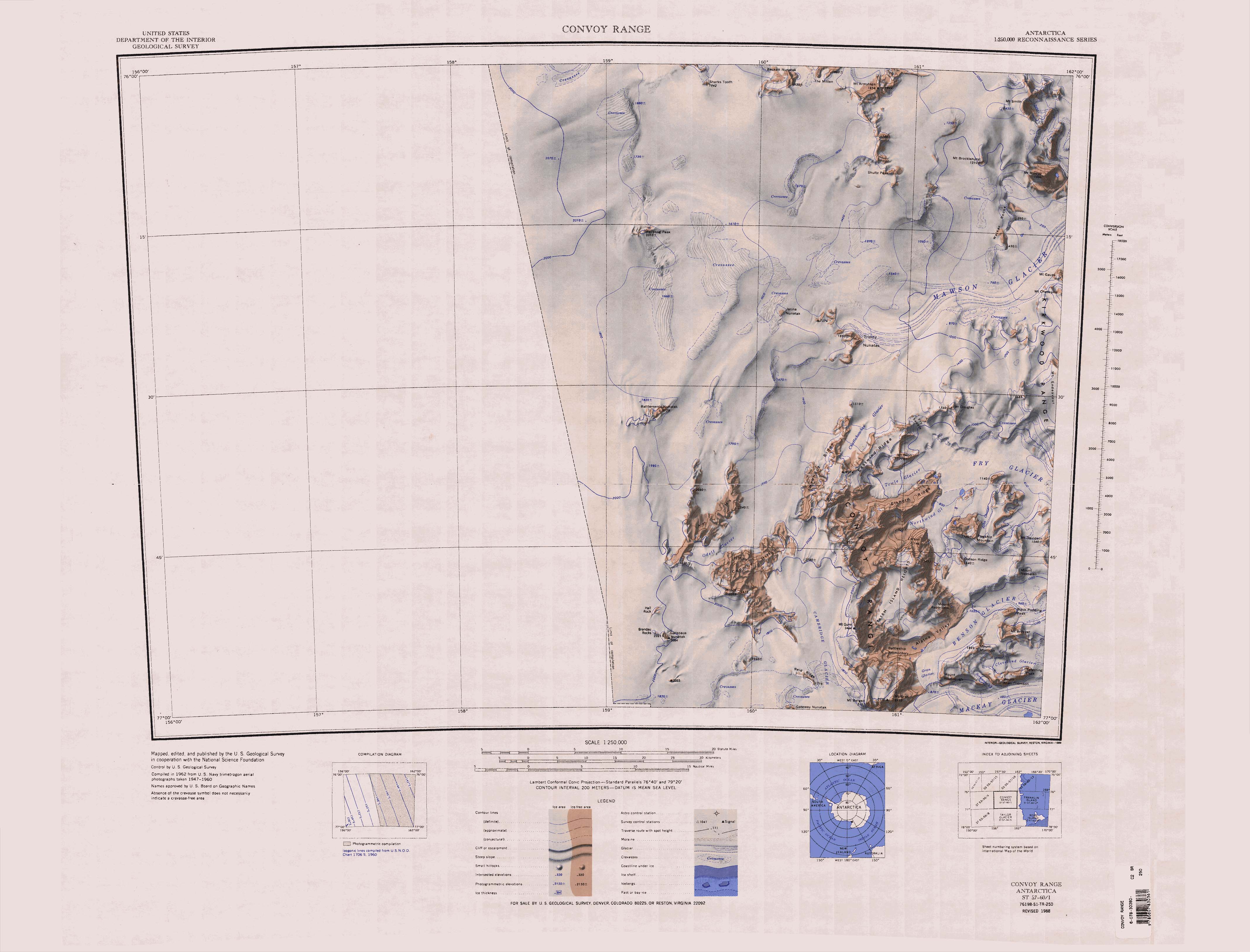
English: 1:250,000-scale topographic reconnaissance map of the Convoy Range area from 156°-162'E to 76°-77°S in Antarctica. Mapped, edited and published by the U.S. Geological Survey in cooperation with the National Science Foundation. |
|||
| Date | ||||
| Source | http://usarc.usgs.gov/drg_dload.shtml | |||
| Author | United States Geological Survey | |||
| Permission (Reusing this file) |
|
File history
Click on a date/time to view the file as it appeared at that time.
| Date/Time | Thumbnail | Dimensions | User | Comment | |
|---|---|---|---|---|---|
| current | 13:24, 17 April 2013 | | 4,271 × 3,254 (1.1 MB) | 4ing | == {{int:filedesc}} == {{Information |description={{en|1=1:250,000-scale topographic reconnaissance map of the Convoy Range area from 156°-162'E to 76°-77°S in Antarctica. Mapped, edited and published by the U.S. Geological Survey in cooperation wit... |
File usage
The following pages on the English Wikipedia use this file (pages on other projects are not listed):
Global file usage
The following other wikis use this file:
- Usage on ceb.wikipedia.org
- Usage on de.wikipedia.org
- Antarktische Trockentäler
- Fry-Gletscher
- Mackay-Gletscher
- Mawson-Gletscher
- Mount Murray
- Convoy Range
- Kirkwood Range
- Mount Smith
- Alatna Valley
- Mount Morrison (Viktorialand)
- Cambridge-Gletscher
- Coombs Hills
- Gateway-Nunatak
- Mount Brøgger
- Northwind-Gletscher
- Mount Nespelen
- Referring Peak
- Elkhorn Ridge
- Mount Davidson
- Allan Hills
- Towle-Gletscher
- Battlements-Nunatak
- Brandau Rocks
- Carapace-Nunatak
- Mount Brooke
- Cargo Pond
- Reckling Peak
- Hall Rock
- Usage on fr.wikipedia.org
- Usage on he.wikipedia.org
- Usage on it.wikipedia.org
View more global usage of this file.