
Size of this PNG preview of this SVG file: 432 × 600 pixels. Other resolutions: 173 × 240 pixels | 346 × 480 pixels | 553 × 768 pixels | 737 × 1,024 pixels | 1,475 × 2,048 pixels | 1,163 × 1,615 pixels.
Original file (SVG file, nominally 1,163 × 1,615 pixels, file size: 60 KB)
| This is a file from the Wikimedia Commons. Information from its description page there is shown below. Commons is a freely licensed media file repository. You can help. |
Summary
| Description |
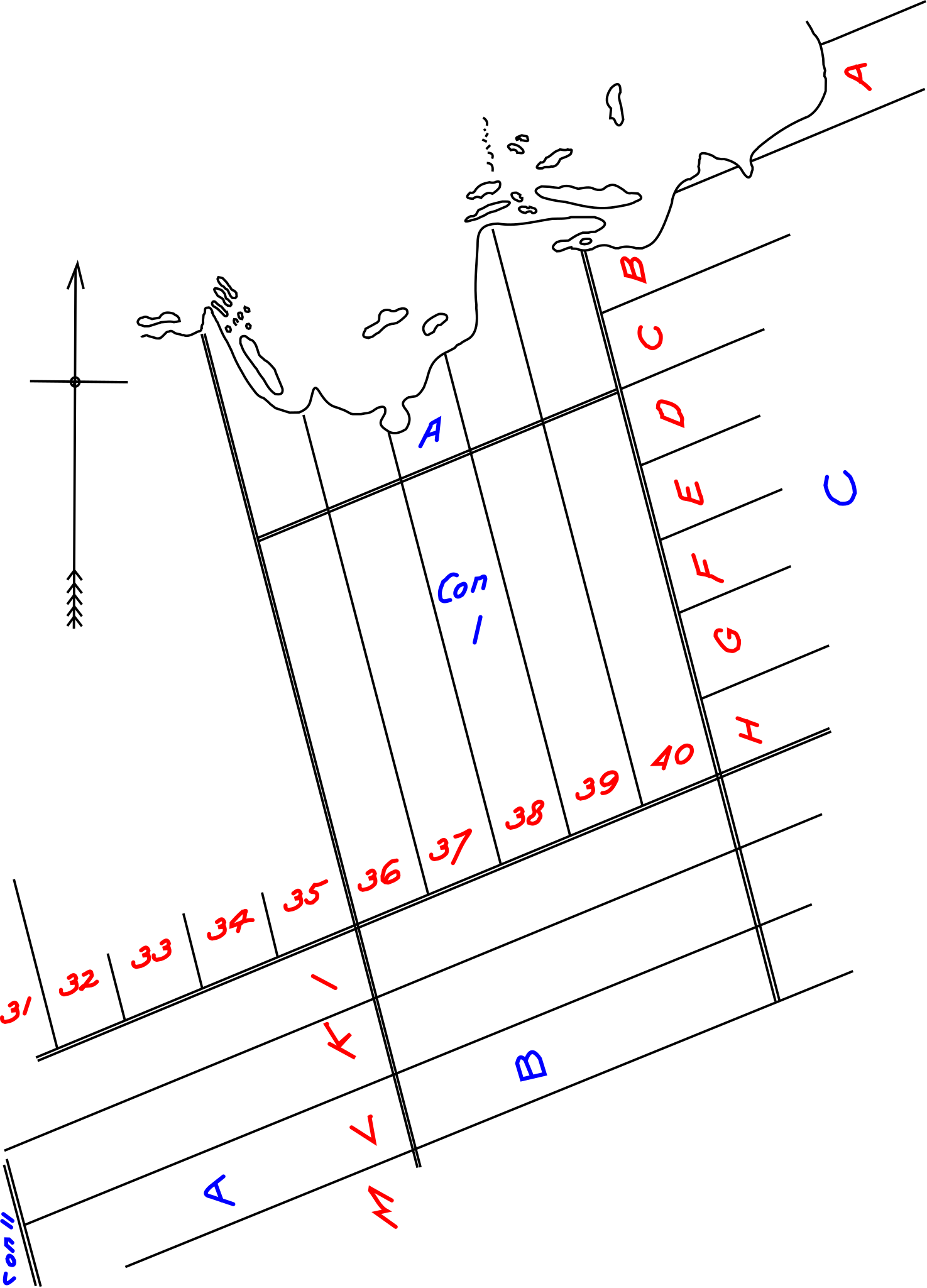
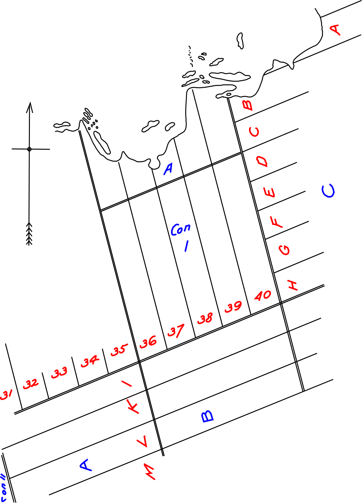
English: Bytown map: lots in the Township of Nepean; early Ottawa. This shows lots that were to become LeBreton Flats, owned by John LeBreton, originally owned by Robert Randall. Shows also islands of Chaudiere Falls. The time period is 1797 to 1826 and later. Lord Dalhousie, and Colonel By also ended up with lots from this map. |
| Date | |
| Source | Hill, Hamnett P.; Robert Randall and the Le Breton Flats; James Hope and Sons, Ottawa., page 6. |
| Author | Hamnett P. Hill, originally Township of Nepean |
Licensing
This media file is in the public domain in the United States. This applies to U.S. works where the copyright has expired, often because its first publication occurred prior to January 1, 1929, and if not then due to lack of notice or renewal. See this page for further explanation.
|
 | |
 |
This image might not be in the public domain outside of the United States; this especially applies in the countries and areas that do not apply the rule of the shorter term for US works, such as Canada, Mainland China (not Hong Kong or Macao), Germany, Mexico, and Switzerland. The creator and year of publication are essential information and must be provided. See Wikipedia:Public domain and Wikipedia:Copyrights for more details.
|
File history
Click on a date/time to view the file as it appeared at that time.
| Date/Time | Thumbnail | Dimensions | User | Comment | |
|---|---|---|---|---|---|
| current | 01:49, 24 August 2011 | | 1,163 × 1,615 (60 KB) | SunKing2 |
File usage
The following pages on the English Wikipedia use this file (pages on other projects are not listed):