Size of this preview: 800 × 538 pixels. Other resolutions: 320 × 215 pixels | 640 × 430 pixels | 971 × 653 pixels.
Original file (971 × 653 pixels, file size: 373 KB, MIME type: image/jpeg)
| This is a file from the Wikimedia Commons. Information from its description page there is shown below. Commons is a freely licensed media file repository. You can help. |
Summary
| Description |
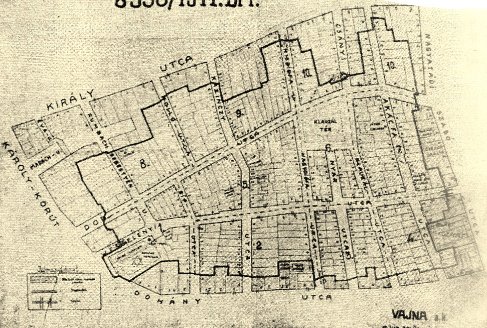
Magyar: A budapesti gettó alaprajza (1944)
English: Contour Map of the Ghetto of Budapest (1944)
Deutsch: Ghettogrenzen im Dekret von de:Gábor Vajna, bei: de:Randolph L. Braham: The politics of genocide. The Holocaust in Hungary, Columbia University Press, New York 1981, S. 852 |
| Date | |
| Source | [Braham, Randolph L.: A népirtás politikája Budapest, 1997; online page: [1] |
| Author | Gábor Vajna |
Licensing
| This work is ineligible for copyright and therefore in the public domain because it consists entirely of information that is common property and contains no original authorship. |
This file is in the public domain because this is an official document of the Royal Hungarian Government
|
File history
Click on a date/time to view the file as it appeared at that time.
| Date/Time | Thumbnail | Dimensions | User | Comment | |
|---|---|---|---|---|---|
| current | 16:43, 15 January 2014 | | 971 × 653 (373 KB) | Vadaro | {{Information |Description={{hu|1=A budapesti gettó alaprajza (1944)}} {{en|1= Map of Budapest Ghetto (1944)}} Budapest, 1997 |Source=[Braham, Randolph L.: A népirtás politikája Budapest, 1997; online page: [http://mek.oszk.hu/11500/11506/html/old... |
File usage
The following pages on the English Wikipedia use this file (pages on other projects are not listed):
Global file usage
The following other wikis use this file:
- Usage on ba.wikipedia.org
- Usage on de.wikipedia.org
- Usage on fr.wikipedia.org
- Usage on he.wikipedia.org
- Usage on hu.wikipedia.org
- Usage on it.wikipedia.org
- Usage on no.wikipedia.org
- Usage on uk.wikipedia.org
- Usage on www.wikidata.org