
Size of this preview: 656 × 600 pixels. Other resolutions: 263 × 240 pixels | 525 × 480 pixels | 840 × 768 pixels | 1,120 × 1,024 pixels | 1,580 × 1,444 pixels.
Original file (1,580 × 1,444 pixels, file size: 573 KB, MIME type: image/jpeg)
| This is a file from the Wikimedia Commons. Information from its description page there is shown below. Commons is a freely licensed media file repository. You can help. |
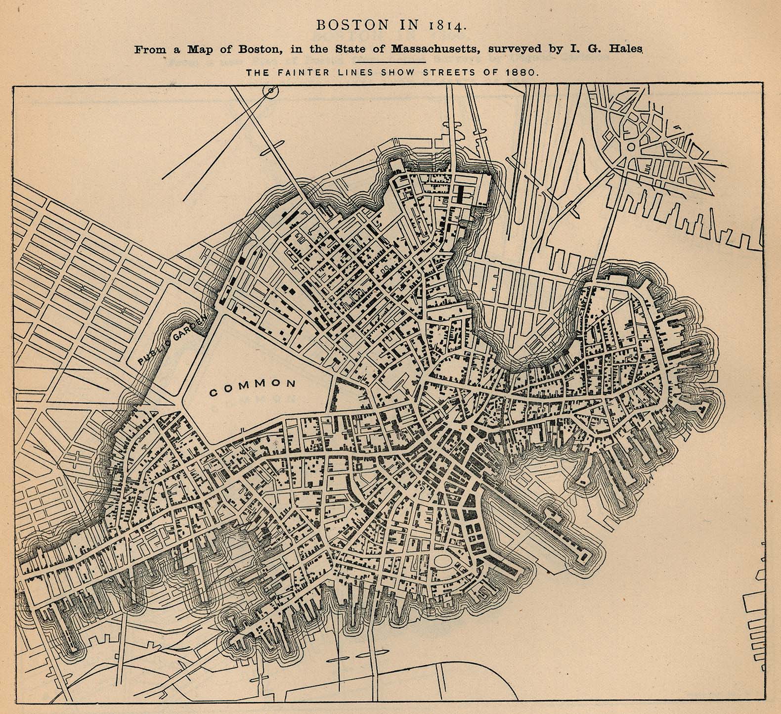
"Boston in 1814. From a map of Boston, in the State of Massachusetts, Surveyed by I.G. Hales" "The fainter lines show streets of 1880." From Report on the Social Statistics of Cities, Compiled by George E. Waring, Jr., United States. Census Office, Part I, 1886.
This image or file is a work of a United States Census Bureau employee, taken or made as part of that person's official duties. As a work of the U.S. federal government, the image is in the public domain.
|
 |
Source: http://www.lib.utexas.edu/maps/historical/boston_1814.jpg
File history
Click on a date/time to view the file as it appeared at that time.
| Date/Time | Thumbnail | Dimensions | User | Comment | |
|---|---|---|---|---|---|
| current | 03:42, 12 March 2007 | | 1,580 × 1,444 (573 KB) | Beland | "Boston in 1814. From a map of Boston, in the State of Massachusetts, Surveyed by I.G. Hales" "The fainter lines show streets of 1880." From Report on the Social Statistics of Cities, Compiled by George E. Waring, Jr., United States. Census Office, Part I |
File usage
No pages on the English Wikipedia use this file (pages on other projects are not listed).