Size of this preview: 800 × 487 pixels. Other resolutions: 320 × 195 pixels | 640 × 390 pixels | 1,024 × 623 pixels | 1,280 × 779 pixels | 2,282 × 1,389 pixels.
Original file (2,282 × 1,389 pixels, file size: 2.39 MB, MIME type: image/jpeg)
| This is a file from the Wikimedia Commons. Information from its description page there is shown below. Commons is a freely licensed media file repository. You can help. |
Summary
| Description |
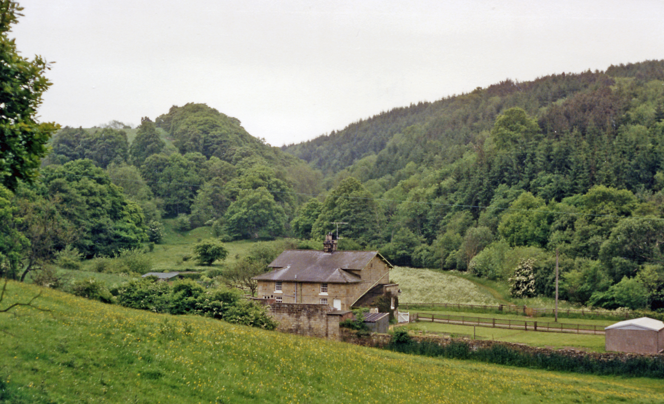
English: Beckhole station site/remains. View SW, to the end of the line, which had until 1865 been the upper end of a rope-worked incline section of the Grosmont - Pickering section of the 1836 Whitby & Pickering Railway - horse-worked. In 1865 the NER built a deviation from Grosmont to replace the incline, but the stub to Beckhole was retained, for goods working, also a passenger service in summer 1908-1914. ['Not many people know about' Beckhole?] |
| Date | |
| Source | From geograph.org.uk |
| Author | Ben Brooksbank |
| Permission (Reusing this file) |
Creative Commons Attribution Share-alike license 2.0 |
| Camera location | | View this and other nearby images on: OpenStreetMap |
|---|
Licensing

|
This image was taken from the Geograph project collection. See this photograph's page on the Geograph website for the photographer's contact details. The copyright on this image is owned by Ben Brooksbank and is licensed for reuse under the Creative Commons Attribution-ShareAlike 2.0 license.
|
This file is licensed under the Creative Commons Attribution-Share Alike 2.0 Generic license.
Attribution: Ben Brooksbank
- You are free:
- to share – to copy, distribute and transmit the work
- to remix – to adapt the work
- Under the following conditions:
- attribution – You must give appropriate credit, provide a link to the license, and indicate if changes were made. You may do so in any reasonable manner, but not in any way that suggests the licensor endorses you or your use.
- share alike – If you remix, transform, or build upon the material, you must distribute your contributions under the same or compatible license as the original.
File history
Click on a date/time to view the file as it appeared at that time.
| Date/Time | Thumbnail | Dimensions | User | Comment | |
|---|---|---|---|---|---|
| current | 15:08, 27 December 2012 | | 2,282 × 1,389 (2.39 MB) | Chevin | == {{int:filedesc}} == {{Information |Description={{en|1='''Beckhole station site/remains.'''<br/> View SW, to the end of the line, which had until 1865 been the upper end of a rope-worked incline section of the Grosmont - Pickering section of the 1836... |
File usage
The following pages on the English Wikipedia use this file (pages on other projects are not listed):
Global file usage
The following other wikis use this file:
- Usage on www.wikidata.org