
Size of this preview: 719 × 599 pixels. Other resolutions: 288 × 240 pixels | 576 × 480 pixels | 921 × 768 pixels | 1,229 × 1,024 pixels | 1,442 × 1,202 pixels.
Original file (1,442 × 1,202 pixels, file size: 1.07 MB, MIME type: image/jpeg)
| This is a file from the Wikimedia Commons. Information from its description page there is shown below. Commons is a freely licensed media file repository. You can help. |
Summary
| Description |
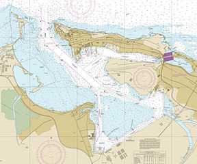
English: This is a screen shot of a map available for public usage at the US agency, National Oceanic and Atmospheric Administration, United States government. The shot was taken on December 11, 2015, for use in Wikipedia. |
| Date | |
| Source | This is a screen capture of the on-line viewable chart of the San Juan Bay available for public usage at NOAA : National Oceanic and Atmospheric Administration, United States government. The direct link to the map is: http://www.charts.noaa.gov/OnLineViewer/25670.shtml |
| Author | National Oceanic and Atmospheric Administration, United States government |
Licensing
This image is in the public domain because it contains materials that originally came from the U.S. National Oceanic and Atmospheric Administration, taken or made as part of an employee's official duties.
|
File history
Click on a date/time to view the file as it appeared at that time.
| Date/Time | Thumbnail | Dimensions | User | Comment | |
|---|---|---|---|---|---|
| current | 16:00, 11 December 2015 | | 1,442 × 1,202 (1.07 MB) | Caballero1967 | User created page with UploadWizard |
File usage
The following pages on the English Wikipedia use this file (pages on other projects are not listed):
Global file usage
The following other wikis use this file:
- Usage on ceb.wikipedia.org
- Usage on es.wikipedia.org
- Usage on uk.wikipedia.org
- Usage on www.wikidata.org