No higher resolution available.
Bachelor_and_Sauvie_Island_map.jpg (500 × 400 pixels, file size: 89 KB, MIME type: image/jpeg)
| This is a file from the Wikimedia Commons. Information from its description page there is shown below. Commons is a freely licensed media file repository. You can help. |
Summary
| Description |
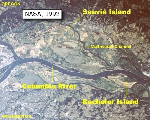
English: Map created from satellite image looking south at Sauvie Island and Bachelor Island in the Columbia River |
| Date | between 12 September 1992 and 20 September 1992 |
| Source | U.S. Geological Survey, scroll down to "Along the Journey - March 29, 1806" |
| Author | NASA |
| Other versions | NASA Earth from Space 2002 #STS047-096-066 |
Licensing
| This file is in the public domain in the United States because it was solely created by NASA. NASA copyright policy states that "NASA material is not protected by copyright unless noted". (See Template:PD-USGov, NASA copyright policy page or JPL Image Use Policy.) | ||
 |
Warnings:
|
File history
Click on a date/time to view the file as it appeared at that time.
| Date/Time | Thumbnail | Dimensions | User | Comment | |
|---|---|---|---|---|---|
| current | 20:54, 10 August 2011 | | 500 × 400 (89 KB) | Jsayre64 | {{Information |Description ={{en|1=Map created from satellite image looking south at Sauvie Island and Bachelor Island in the Columbia River}} |Source =[http://vulcan.wr.usgs.gov/LivingWith/Historical/LewisClark/volcanoes_lewis_clark_march_29_1 |
File usage
The following pages on the English Wikipedia use this file (pages on other projects are not listed):
Global file usage
The following other wikis use this file:
- Usage on ceb.wikipedia.org
- Usage on ja.wikipedia.org
- Usage on www.wikidata.org