
Size of this preview: 762 × 600 pixels. Other resolutions: 305 × 240 pixels | 610 × 480 pixels | 976 × 768 pixels | 1,280 × 1,007 pixels | 2,560 × 2,015 pixels | 6,557 × 5,160 pixels.
Original file (6,557 × 5,160 pixels, file size: 2.95 MB, MIME type: image/jpeg)
| This is a file from the Wikimedia Commons. Information from its description page there is shown below. Commons is a freely licensed media file repository. You can help. |
Summary
| Description |
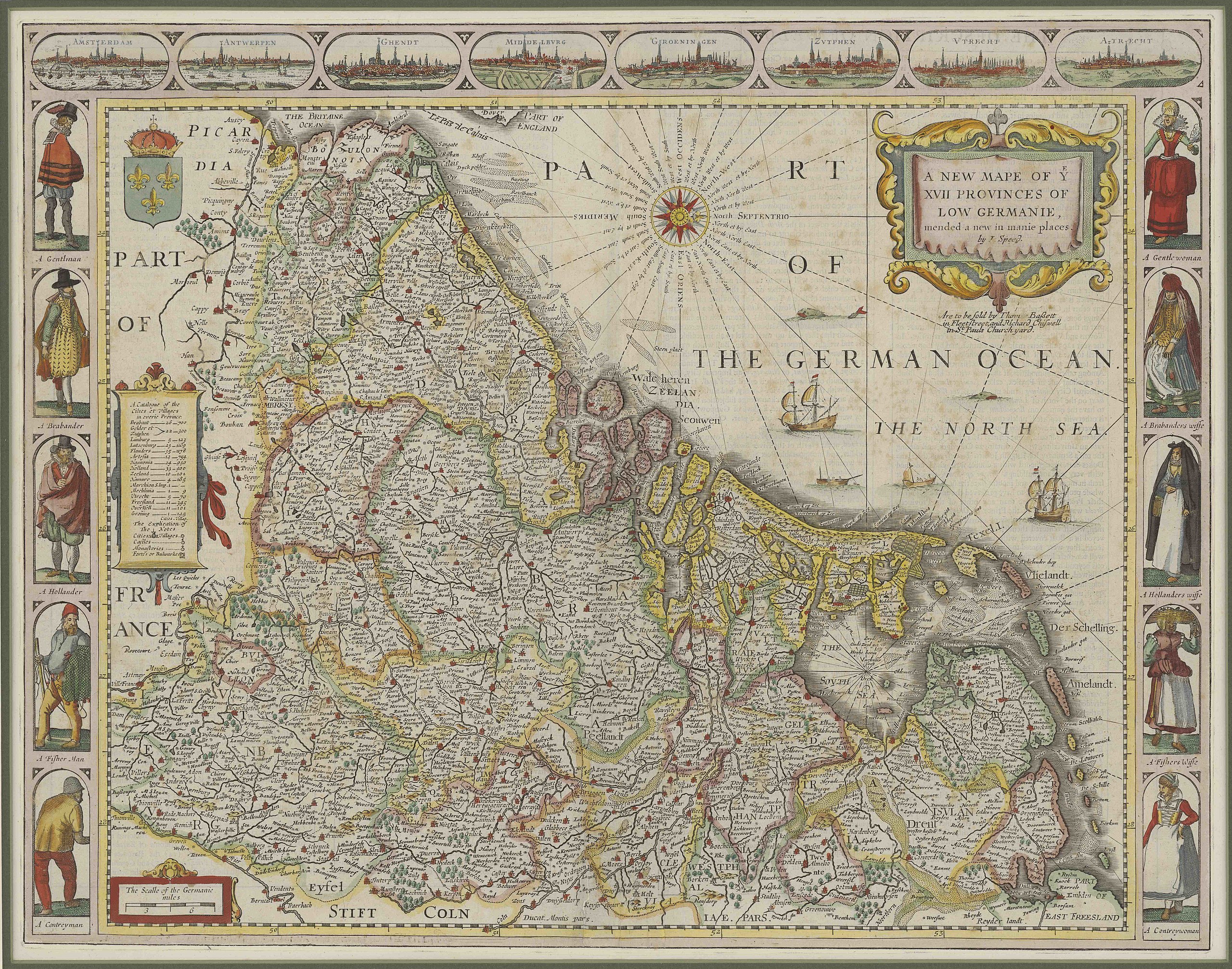
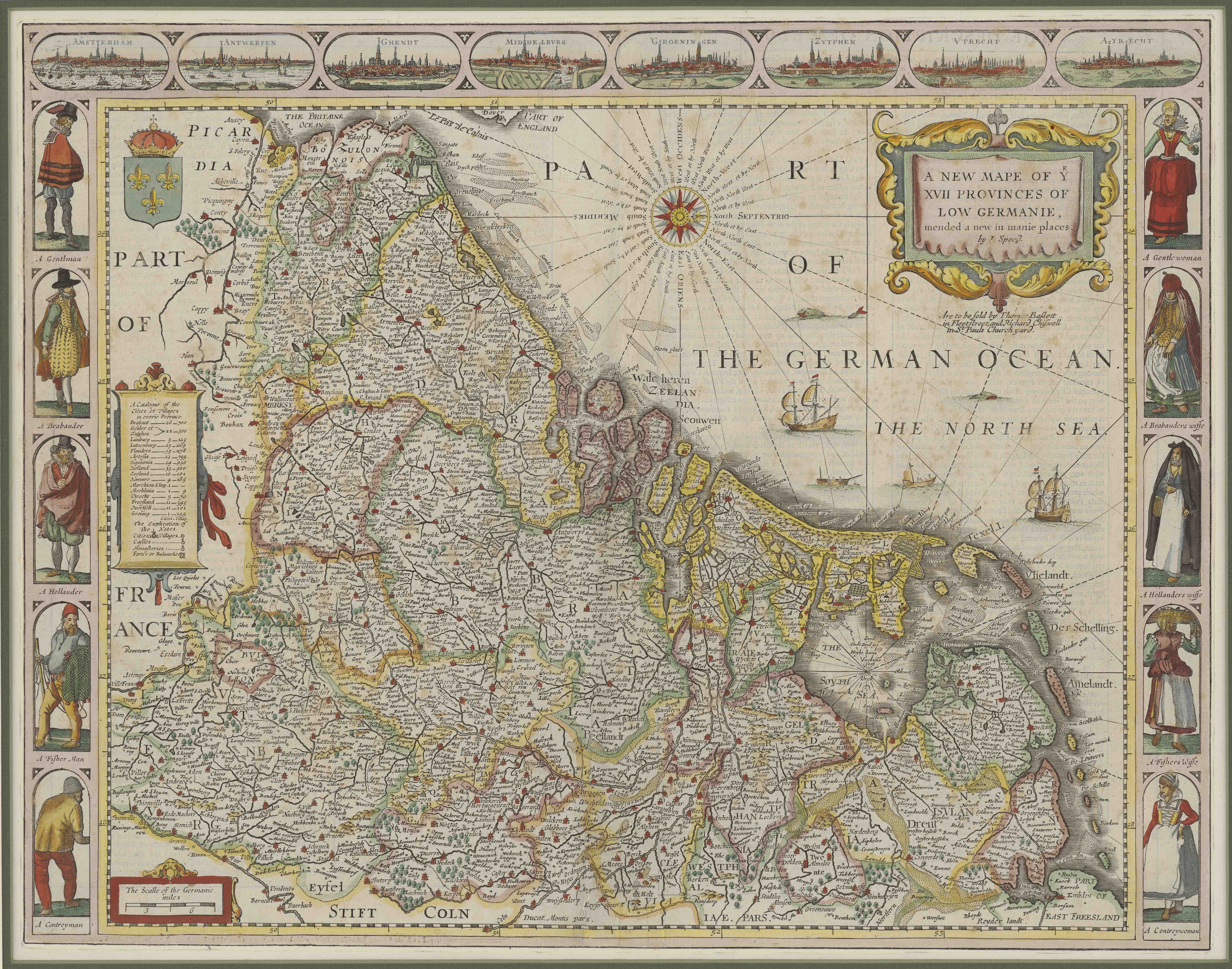
English: A new mape of ye XVII provinces of Low Germanie / mended a new in manie places |
| Date | 1626 |
| Source | www.jouwprenten.nl former image came from: Bibliotheek van de Universiteit van Amsterdam |
| Author | Abraham Goos; John Speed |
| Other versions |
|
_1626.jpg)
Nederland; Belgie; Engelse uitgave
Licensing
|
This work is in the public domain in its country of origin and other countries and areas where the copyright term is the author's life plus 100 years or fewer. | |
| This file has been identified as being free of known restrictions under copyright law, including all related and neighboring rights. | |
File history
Click on a date/time to view the file as it appeared at that time.
| Date/Time | Thumbnail | Dimensions | User | Comment | |
|---|---|---|---|---|---|
| current | 12:44, 17 September 2012 | | 6,557 × 5,160 (2.95 MB) | Joopr132 | Colored version, higher resolution, new source |
| 12:42, 17 September 2012 | No thumbnail | 6,557 × 5,160 (2.95 MB) | Joopr132 | Colored version, higher resolution, new source | |
| 11:06, 4 December 2010 |  | 3,360 × 2,576 (2.13 MB) | Joopr | {{Information |Description={{en|1=A new mape of ye XVII provinces of Low Germanie / mended a new in manie places}} |Source=[http://dpc.uba.uva.nl/cgi/i/image/image-idx?sid=09d0f88a633dd4e99b7610df1b43bcd1;c=carto;q1=Goos;rgn1=carto_all;q2=,Speed;op2=And;r |
File usage
No pages on the English Wikipedia use this file (pages on other projects are not listed).
Global file usage
The following other wikis use this file:
- Usage on nl.wikipedia.org