File:BMEWS Geopolitical Significance - Clear Air Force Station, Ballistic Missile Early Warning System Site II, One mile west of mile marker 293.5 on Parks Highway, 5 miles HAER AK-30-A (sheet 2 of 9).png

Original file(14,425 × 9,899 pixels, file size: 4.87 MB, MIME type: image/png)

This image is a JPEG version of the original TIF image at File: BMEWS Geopolitical Significance - Clear Air Force Station, Ballistic Missile Early Warning System Site II, One mile west of mile marker 293.5 on Parks Highway, 5 miles HAER AK-30-A (sheet 2 of 9).tif.

However, any edits to the image should be based on the original TIF version in order to prevent generation loss, and both versions should be updated. Do not make edits based on this version.

Summary

Warning The original file is very high-resolution. It might not load properly or could cause your browser to freeze when opened at full size.
BMEWS Geopolitical Significance - Clear Air Force Station, Ballistic Missile Early Warning System Site II, One mile west of mile marker 293.5 on Parks Highway, 5 miles southwest of Anderson, Anderson, Denali Borough, AK
Photographer
Easterling, Kathryn F., creator
Title
BMEWS Geopolitical Significance - Clear Air Force Station, Ballistic Missile Early Warning System Site II, One mile west of mile marker 293.5 on Parks Highway, 5 miles southwest of Anderson, Anderson, Denali Borough, AK
Depicted place Alaska; Denali Borough; Anderson
Date 2003
Medium 24 x 36 in. (D size)
Current location
Library of Congress Prints and Photographs Division Washington, D.C. 20540 USA http://hdl.loc.gov/loc.pnp/pp.print
Accession number
HAER AK-30-A (sheet 2 of 9)
Credit line
This file comes from the Historic American Buildings Survey (HABS), Historic American Engineering Record (HAER) or Historic American Landscapes Survey (HALS). These are programs of the National Park Service established for the purpose of documenting historic places. Records consist of measured drawings, archival photographs, and written reports.

This tag does not indicate the copyright status of the attached work. A normal copyright tag is still required. See Commons:Licensing.

Notes
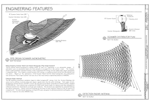
  • Significance: The Ballistic Missile Early Warning System (BMEWS) was constructed in 1958-61 in response to the threat of a potential Intercontinental Ballistic Missile (ICBM) attack from the Soviet Union (demonstrated by the October 1957 launch of Sputnik). BMEWS Site II at Clear AFS in Alaska was one of three radar sites (the others were located in Greenland and Britain) that covered the polar regions. Although BMEWS was an expansion of existing radar technology rather than a significant innovation, it represented a major engineering achievement. MBEWS was an important part of the deterrence strategy (Mutual Assured Destruction) developed by both sides in the Cold War. It provided a minimum of fifteen minutes advance warning for a nuclear counterstrike, but not a missile defense. BMEWS remained in operation throughout the remainder of the Cold War, although the technology became increasingly antiquated and difficult to maintain in later years.
  • Survey number: HAER AK-30-A
  • Building/structure dates: 1958-1961 Initial Construction
  • Building/structure dates: 1980 Subsequent Work
  • Building/structure dates: 1981 Subsequent Work
  • Building/structure dates: 2000 Subsequent Work
  • Building/structure dates: 2001 Subsequent Work
References

Related names:

United States Air Force; Lincoln Laboratory; Systems Research Group; General Electric; Sylvania Electric; Baker Ford; Patti-McDonald; Empire Gas and Engineering; Miller Brothers; Bohannan Huston, Incorporated, contractor; CH2M HILL, contractor; Kaszynski, Gary, project manager
Source https://www.loc.gov/pictures/item/ak0486.sheet.00002a
Permission
(Reusing this file)
Public domain This image or media file contains material based on a work of a National Park Service employee, created as part of that person's official duties. As a work of the U.S. federal government, such work is in the public domain in the United States. See the NPS website and NPS copyright policy for more information.
Other versions
Object location64° 20′ 39.01″ N, 149° 11′ 12.98″ W Kartographer map based on OpenStreetMap.View this and other nearby images on: OpenStreetMapinfo

Captions

Add a one-line explanation of what this file represents

Items portrayed in this file

depicts

64°20'39.01200000002"N, 149°11'12.98399999994"W

64°20'39.01200000002"N, 149°11'12.98399999994"W

image/png

b69b571ac6f70ceb069c7232812ed90a8683dd92

5,110,958 byte

9,899 pixel

14,425 pixel

File history

Click on a date/time to view the file as it appeared at that time.

Date/TimeThumbnailDimensionsUserComment
current12:02, 29 June 2014Thumbnail for version as of 12:02, 29 June 201414,425 × 9,899 (4.87 MB){{Compressed version|file=File:BMEWS_Geopolitical_Significance_-_Clear_Air_Force_Station,_Ballistic_Missile_Early_Warning_System_Site_II,_One_mile_west_of_mile_marker_293.5_on_Parks_Highway,_5_miles_HAER_AK-30-A_(sheet_2_of_9).tif|thumb=nothumb}} =={{i...
The following pages on the English Wikipedia use this file (pages on other projects are not listed):

Metadata