
No higher resolution available.
Australia_map.png (330 × 354 pixels, file size: 22 KB, MIME type: image/png)
| This is a file from the Wikimedia Commons. Information from its description page there is shown below. Commons is a freely licensed media file repository. You can help. |
Summary
| Description |
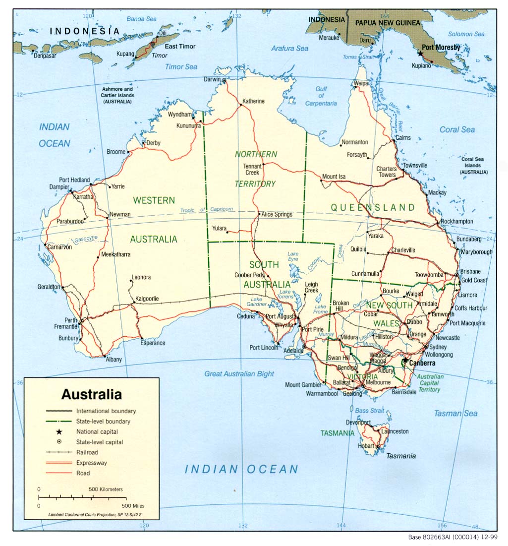
English: Australia - Outline map with coastline, borders, major and regional cities I can provide it in photoshop format on request, with landmass, coastline, state borders, major and regional cities all in separate layers for making customised maps. The original source map is also on a separate (invisible) layer. |
| Date | |
| Source |
I created this from the public domain image at: http://www.lib.utexas.edu/maps/australia/australia_pol99.jpg |
| Author | Chuq at English Wikipedia |
Licensing
| This file is licensed under the Creative Commons Attribution-Share Alike 3.0 Unported license. Subject to disclaimers. | ||
| ||
| This licensing tag was added to this file as part of the GFDL licensing update. |

|
Permission is granted to copy, distribute and/or modify this document under the terms of the GNU Free Documentation License, Version 1.2 or any later version published by the Free Software Foundation; with no Invariant Sections, no Front-Cover Texts, and no Back-Cover Texts. A copy of the license is included in the section entitled GNU Free Documentation License. Subject to disclaimers. |
Original upload log
The original description page was here. All following user names refer to en.wikipedia.
| Date/Time | Dimensions | User | Comment |
|---|---|---|---|
| 2004-10-13 00:23 | 330×354× (57950 bytes) | Chuq | Reverted to earlier revision |
| 2004-10-09 03:37 | 330×354× (22130 bytes) | Neutrality | Map of [[Australia]]. {{PD-USGov-CIA-WF}} |
| 2004-10-03 05:32 | 330×354× (57950 bytes) | Chuq | Australia - Outline map with coastline, borders, major and regional cities {{gfdl}} |
File history
Click on a date/time to view the file as it appeared at that time.
| Date/Time | Thumbnail | Dimensions | User | Comment | |
|---|---|---|---|---|---|
| current | 01:47, 29 November 2016 | | 330 × 354 (22 KB) | OgreBot | (BOT): Reverting to most recent version before archival |
| 01:47, 29 November 2016 |  | 330 × 354 (22 KB) | OgreBot | (BOT): Uploading old version of file from en.wikipedia; originally uploaded on 2004-10-13 00:23:48 by Chuq | |
| 01:46, 29 November 2016 |  | 330 × 354 (22 KB) | OgreBot | (BOT): Uploading old version of file from en.wikipedia; originally uploaded on 2004-10-09 03:37:19 by Neutrality | |
| 01:46, 29 November 2016 |  | 330 × 354 (22 KB) | Kingofthedead | Transferred from en.wikipedia |
File usage
The following pages on the English Wikipedia use this file (pages on other projects are not listed):
Global file usage
The following other wikis use this file:
- Usage on uk.wikipedia.org