Size of this preview: 408 × 599 pixels. Other resolutions: 163 × 240 pixels | 327 × 480 pixels | 523 × 768 pixels | 697 × 1,024 pixels | 2,528 × 3,712 pixels.
Original file (2,528 × 3,712 pixels, file size: 1.38 MB, MIME type: image/jpeg)
File history
Click on a date/time to view the file as it appeared at that time.
| Date/Time | Thumbnail | Dimensions | User | Comment | |
|---|---|---|---|---|---|
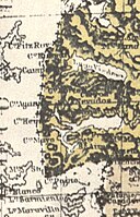
| current | 23:23, 11 January 2008 |  | 2,528 × 3,712 (1.38 MB) | Keysanger | {{Information |Description=Here is a reproduction of the map of the Governorships of Santa Cruz and Tierra del Fuego included in the "Official Yearbook of the Argentine Republic", "published by the Ministery of the Interior, Foreign Affairs and Agricultur |
File usage
No pages on the English Wikipedia use this file (pages on other projects are not listed).


