No higher resolution available.
Ancient_and_Modern_-_geograph.org.uk_-_1337165.jpg (640 × 480 pixels, file size: 91 KB, MIME type: image/jpeg)
| This is a file from the Wikimedia Commons. Information from its description page there is shown below. Commons is a freely licensed media file repository. You can help. |
Summary
| Description |
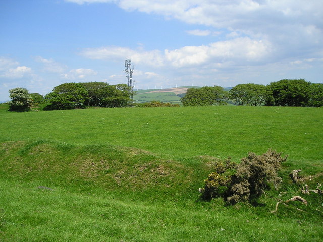
English: Ancient and Modern This is a view across the hill fort of Hen Caer. I am standing on the outermost of the 2 ramparts which are separated by a ditch. The large enclosed area would have protected livestock in the event of attack. The mast is also taking advantage of the elevated position and in the distance a wind farm can be seen. |
| Date | |
| Source | From geograph.org.uk |
| Author | Marion Phillips |
| Attribution (required by the license) | Marion Phillips / Ancient and Modern / |
| Camera location | | View this and other nearby images on: OpenStreetMap |
|---|
_heading:22.00&language=en)
| Object location | | View this and other nearby images on: OpenStreetMap |
|---|
_heading:22.00&language=en)
Licensing

|
This image was taken from the Geograph project collection. See this photograph's page on the Geograph website for the photographer's contact details. The copyright on this image is owned by Marion Phillips and is licensed for reuse under the Creative Commons Attribution-ShareAlike 2.0 license.
|
This file is licensed under the Creative Commons Attribution-Share Alike 2.0 Generic license.
Attribution: Marion Phillips
- You are free:
- to share – to copy, distribute and transmit the work
- to remix – to adapt the work
- Under the following conditions:
- attribution – You must give appropriate credit, provide a link to the license, and indicate if changes were made. You may do so in any reasonable manner, but not in any way that suggests the licensor endorses you or your use.
- share alike – If you remix, transform, or build upon the material, you must distribute your contributions under the same or compatible license as the original.

|
The categories of this image need checking. You can do so here.
|
File history
Click on a date/time to view the file as it appeared at that time.
| Date/Time | Thumbnail | Dimensions | User | Comment | |
|---|---|---|---|---|---|
| current | 00:30, 28 February 2011 | | 640 × 480 (91 KB) | GeographBot | == {{int:filedesc}} == {{Information |description={{en|1=Ancient and Modern This is a view across the hill fort of Hen Caer. I am standing on the outermost of the 2 ramparts which are separated by a ditch. The large enclosed area would have protected live |
File usage
The following pages on the English Wikipedia use this file (pages on other projects are not listed):
Global file usage
The following other wikis use this file:
- Usage on cy.wikipedia.org
- Usage on www.wikidata.org