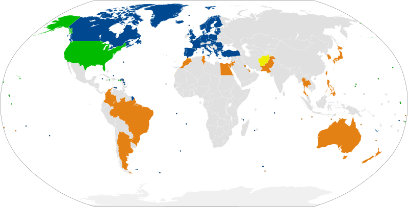
Size of this PNG preview of this SVG file: 800 × 406 pixels. Other resolutions: 320 × 162 pixels | 640 × 325 pixels | 1,024 × 520 pixels | 1,280 × 650 pixels | 2,560 × 1,300 pixels | 2,756 × 1,399 pixels.
Original file (SVG file, nominally 2,756 × 1,399 pixels, file size: 858 KB)
File history
Click on a date/time to view the file as it appeared at that time.
| Date/Time | Thumbnail | Dimensions | User | Comment | |
|---|---|---|---|---|---|
| current | 14:51, 29 June 2024 |  | 2,756 × 1,399 (858 KB) | Danlaycock | update kenya |
| 20:16, 8 March 2024 |  | 2,756 × 1,399 (858 KB) | Iktsokh | Sweden | |
| 17:13, 4 April 2023 |  | 2,756 × 1,399 (813 KB) | Hanzlan | NATO+Finland | |
| 17:54, 6 November 2022 |  | 2,756 × 1,399 (813 KB) | Danlaycock | Add former MNNA in yellow | |
| 21:33, 25 July 2022 |  | 2,756 × 1,399 (813 KB) | M.Bitton | Reverted to version as of 21:08, 25 July 2022 (UTC): so what if it does? | |
| 21:20, 25 July 2022 |  | 2,756 × 1,399 (813 KB) | Kwamikagami | the US specifically recognizes that WSah is part of Moroc, just as it recognizes Taiwan as separate. | |
| 21:08, 25 July 2022 |  | 2,756 × 1,399 (813 KB) | Kwamikagami | color territories, no dots | |
| 12:09, 25 July 2022 |  | 2,756 × 1,399 (812 KB) | M.Bitton | rv recent change. The U.S. law designates the allies and not the international borders | |
| 11:04, 25 July 2022 |  | 2,756 × 1,399 (812 KB) | Kwamikagami | more distinctive green | |
| 10:13, 25 July 2022 |  | 2,756 × 1,399 (812 KB) | Kwamikagami | map redone from scratch, use NATO blue |
File usage
The following 2 pages use this file:
Global file usage
The following other wikis use this file:
- Usage on ar.wikipedia.org
- Usage on de.wikipedia.org
- Usage on ru.wikipedia.org
- Usage on sv.wikipedia.org
- Usage on uk.wikipedia.org
