Size of this preview: 383 × 600 pixels. Other resolutions: 153 × 240 pixels | 306 × 480 pixels | 954 × 1,494 pixels.
Original file (954 × 1,494 pixels, file size: 2.54 MB, MIME type: image/png)
| This is a file from the Wikimedia Commons. Information from its description page there is shown below. Commons is a freely licensed media file repository. You can help. |
Summary
| Description |
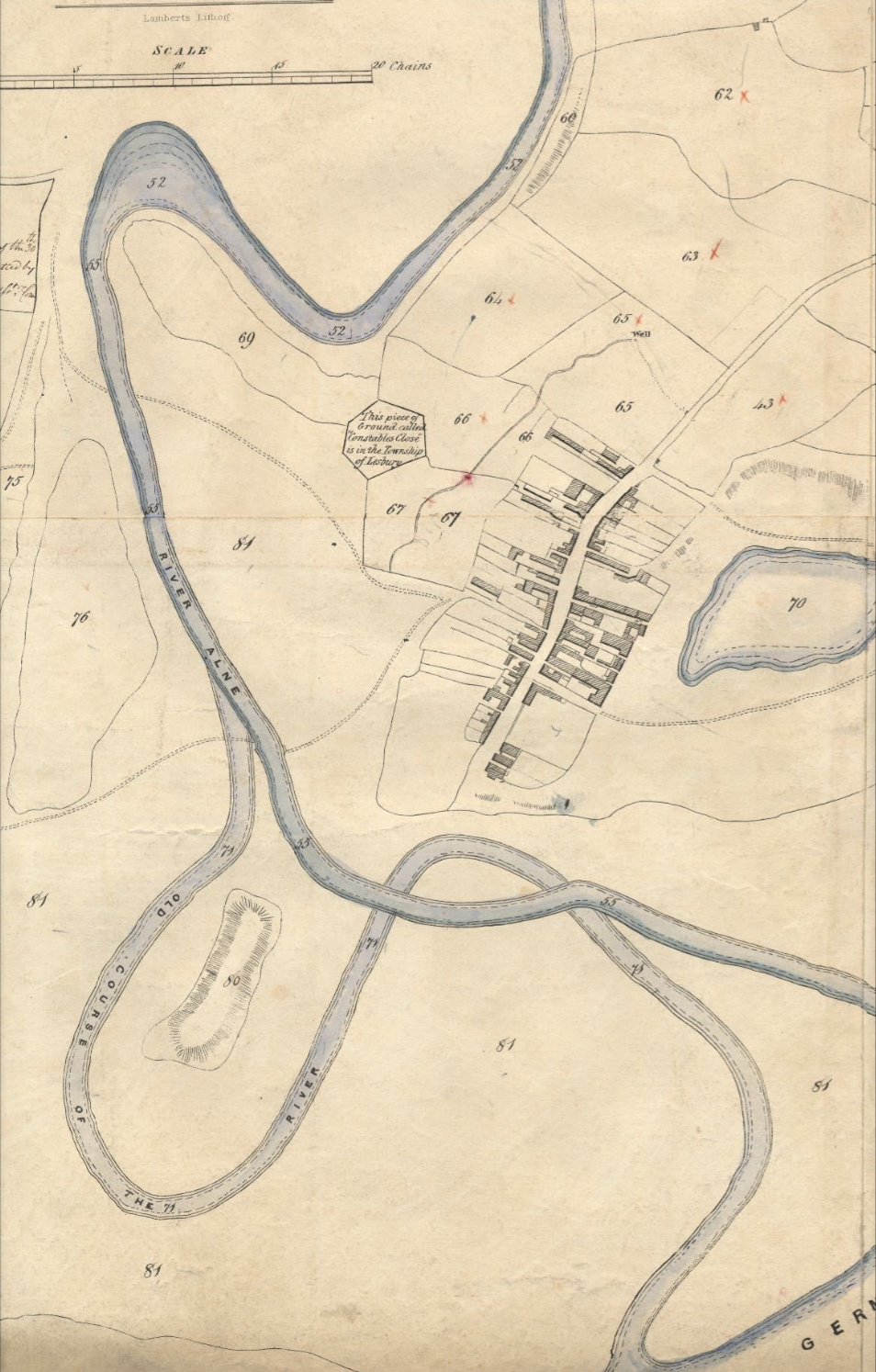
English: Tithe map of Alnmouth, Northumberland, 1843, showing in particular the changed course of the River Aln after a storm in 1806 knocked out an oxbow meander. |
| Date | |
| Source |
Historic Environment Survey for the National Trust Properties on the Northumberland Coast Buston Links, Alnmouth Prepared for the National Trust July 2009 Report No: 0058/1-09 |
| Author |
Report authors: Archaeo-Environment Ltd Marian Cottage Lartington Barnard Castle County Durham DL12 9BP Tithe map dates to 1843, is used in the report, but was not originated by A-E Ltd. |
| Camera location | | View this and other nearby images on: OpenStreetMap |
|---|
Licensing
|
This work is in the public domain in its country of origin and other countries and areas where the copyright term is the author's life plus 70 years or fewer. This work is in the public domain in the United States because it was published (or registered with the U.S. Copyright Office) before January 1, 1929. | |
| This file has been identified as being free of known restrictions under copyright law, including all related and neighboring rights. | |
File history
Click on a date/time to view the file as it appeared at that time.
| Date/Time | Thumbnail | Dimensions | User | Comment | |
|---|---|---|---|---|---|
| current | 19:16, 14 May 2016 | | 954 × 1,494 (2.54 MB) | Tagishsimon | User created page with UploadWizard |
File usage
The following pages on the English Wikipedia use this file (pages on other projects are not listed):