
Size of this preview: 334 × 598 pixels. Other resolutions: 134 × 240 pixels | 494 × 885 pixels.
Original file (494 × 885 pixels, file size: 394 KB, MIME type: image/jpeg)
| This is a file from the Wikimedia Commons. Information from its description page there is shown below. Commons is a freely licensed media file repository. You can help. |
Summary
| Description |
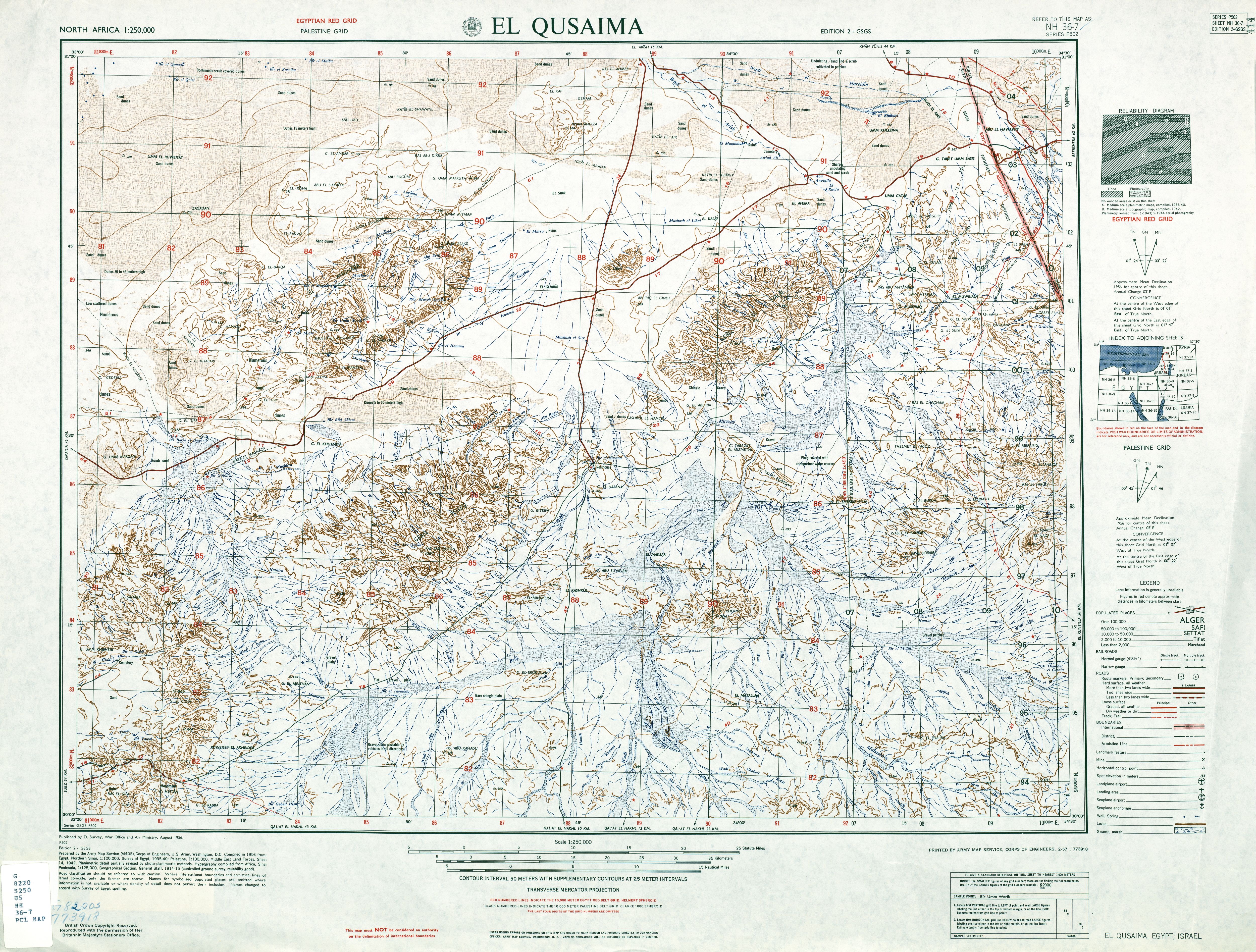
English: Area of former Al 'Awja Neutral Zone |
| Date | |
| Source | http://www.lib.utexas.edu/maps/ams/north_africa/txu-oclc-6949452-nh36-7.jpg |
| Author | Army Map Service, Corps of Engineers, U.S. Army |
Licensing
This file is a work of a U.S. Army soldier or employee, taken or made as part of that person's official duties. As a work of the U.S. federal government, it is in the public domain in the United States.
|
 |
File history
Click on a date/time to view the file as it appeared at that time.
| Date/Time | Thumbnail | Dimensions | User | Comment | |
|---|---|---|---|---|---|
| current | 18:58, 30 June 2009 | | 494 × 885 (394 KB) | Ratzer | {{Information |Description={{en|1=Area of former Al 'Awja Neutral Zone}} |Source=http://www.lib.utexas.edu/maps/ams/north_africa/txu-oclc-6949452-nh36-7.jpg |Author=Army Map Service, Corps of Engineers, U.S. Army |Date=1953 |Permission= |other_versions= } |
File usage
The following pages on the English Wikipedia use this file (pages on other projects are not listed):
Global file usage
The following other wikis use this file:
- Usage on ar.wikipedia.org
- Usage on fi.wikipedia.org
- Usage on fr.wikipedia.org
- Usage on pl.wikipedia.org
- Usage on www.wikidata.org