
Size of this preview: 800 × 545 pixels. Other resolutions: 320 × 218 pixels | 640 × 436 pixels | 1,024 × 698 pixels | 1,280 × 873 pixels | 2,325 × 1,585 pixels.
Original file (2,325 × 1,585 pixels, file size: 917 KB, MIME type: image/jpeg)
| This is a file from the Wikimedia Commons. Information from its description page there is shown below. Commons is a freely licensed media file repository. You can help. |
Summary
| Description |
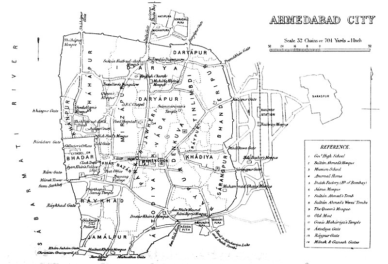
Deutsch: Alte Karte der Stadtumwallung von Ahmedabad, einschließlich Lage der Stadttore. Der Bahnhof befindet sich außerhalb des Festungsgeländes.
English: Map of Ahmedabad |
|||||||||
| Date | ||||||||||
| Source | Gazetteer of the Bombay Presidency. (1896) by James M. Campbell | |||||||||
| Creator |
Various |
|||||||||
| Geotemporal data | ||||||||||
| Bounding box |
|
|||||||||
| Georeferencing | ||||||||||
Licensing
|
This work is in the public domain in its country of origin and other countries and areas where the copyright term is the author's life plus 70 years or fewer. This work is in the public domain in the United States because it was published (or registered with the U.S. Copyright Office) before January 1, 1929. | |
| This file has been identified as being free of known restrictions under copyright law, including all related and neighboring rights. | |
File history
Click on a date/time to view the file as it appeared at that time.
| Date/Time | Thumbnail | Dimensions | User | Comment | |
|---|---|---|---|---|---|
| current | 15:18, 5 November 2014 | | 2,325 × 1,585 (917 KB) | Shyamal | User created page with UploadWizard |
File usage
The following pages on the English Wikipedia use this file (pages on other projects are not listed):
Global file usage
The following other wikis use this file:
- Usage on fa.wikipedia.org
- Usage on gu.wikipedia.org
- Usage on kn.wikipedia.org
- Usage on mr.wikipedia.org
- Usage on ur.wikipedia.org
- Usage on vi.wikipedia.org
- Usage on zh.wikipedia.org