
Size of this preview: 731 × 600 pixels. Other resolutions: 293 × 240 pixels | 585 × 480 pixels | 937 × 768 pixels | 1,249 × 1,024 pixels | 2,497 × 2,048 pixels | 3,097 × 2,540 pixels.
Original file (3,097 × 2,540 pixels, file size: 3.86 MB, MIME type: image/png)
| This is a file from the Wikimedia Commons. Information from its description page there is shown below. Commons is a freely licensed media file repository. You can help. |
Summary
| Description |
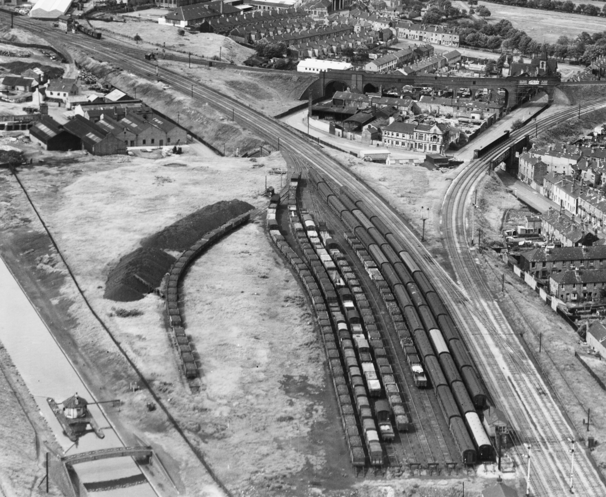
English: Railway yard (now Soho depot) and triangular junction at Winson Green, Birmingham, England. These were part of the London, Midland and Scottish Railway until nationalisation on 1 January 1948.
Each point of the triangle was considered a separate junction: Winson Green Junction (nearest camera), Soho Soap Works Junction (top left) and Soho East Junction (top right); see [1]. Line to Birmingham city centre behind the camera, and to Wolverhampton top left. The line to Perry Barr branches off to the right. The border between Birmingham and Smethwick runs through the far side of the railway junction. 22 August 1948 was a Sunday, which may account for the lack of smoke or activity. |
| Date | |
| Source | https://historicengland.org.uk/images-books/archive/collections/aerial-photos/record/raf_540_78_sffo_0003 |
| Author | Anonymous (RAF photographer) |
| Other versions |
 |

| Camera location | | View this and other nearby images on: OpenStreetMap |
|---|

.png)
.png&action=edit&redlink=1)
.png)
.png¶ms=052.489500_N_-001.940400_E_globe:Earth_type:camera__&language=en)
Licensing
This work created by the United Kingdom Government is in the public domain.
This is because it is one of the following:
HMSO has declared that the expiry of Crown Copyrights applies worldwide (ref: HMSO Email Reply)
|
 |
| Annotations | This image is annotated: View the annotations at Commons |
File history
Click on a date/time to view the file as it appeared at that time.
| Date/Time | Thumbnail | Dimensions | User | Comment | |
|---|---|---|---|---|---|
| current | 14:11, 24 May 2022 | | 3,097 × 2,540 (3.86 MB) | Pigsonthewing | File:Aerial Photo - raf 540 78 sffo 0003.png cropped 42 % horizontally, 42 % vertically using CropTool with lossless mode. |
File usage
The following pages on the English Wikipedia use this file (pages on other projects are not listed):
.png)