Size of this preview: 800 × 498 pixels. Other resolutions: 320 × 199 pixels | 640 × 398 pixels | 1,024 × 637 pixels | 1,280 × 796 pixels | 1,736 × 1,080 pixels.
Original file (1,736 × 1,080 pixels, file size: 3.01 MB, MIME type: image/png)
| This is a file from the Wikimedia Commons. Information from its description page there is shown below. Commons is a freely licensed media file repository. You can help. |
Summary
| Description |
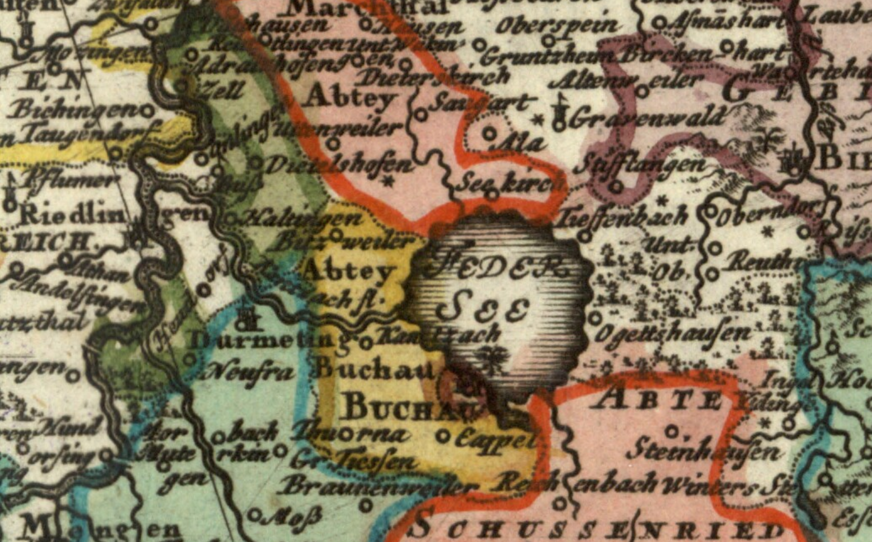
English: Detail of a 1743 map showing the territory of the Imperial Abbey of Buchau (in yellow) and the town of Buchau (in brown) on the shore of the Federsee. The double-headed eagle shown next to the town symbolises the status of Buchau as a self-ruling free imperial city. Map titled Circvli Sveviae Mappa by Johann Matthias Hase published in 1743. |
| Date | |
| Source | Moll's map collection |
| Author | Johann Matthias Hase |
Licensing
|
This work is in the public domain in its country of origin and other countries and areas where the copyright term is the author's life plus 100 years or fewer. | |
| This file has been identified as being free of known restrictions under copyright law, including all related and neighboring rights. | |
File history
Click on a date/time to view the file as it appeared at that time.
| Date/Time | Thumbnail | Dimensions | User | Comment | |
|---|---|---|---|---|---|
| current | 17:06, 1 August 2018 | | 1,736 × 1,080 (3.01 MB) | Lubiesque | User created page with UploadWizard |
File usage
The following pages on the English Wikipedia use this file (pages on other projects are not listed):
Global file usage
The following other wikis use this file:
- Usage on de.wikipedia.org
- Usage on fr.wikipedia.org