Size of this preview: 608 × 600 pixels. Other resolutions: 243 × 240 pixels | 487 × 480 pixels | 880 × 868 pixels.
Original file (880 × 868 pixels, file size: 170 KB, MIME type: image/png)
Summary edit
Licensing edit
| This work is licensed under the Creative Commons Attribution 4.0 License. |
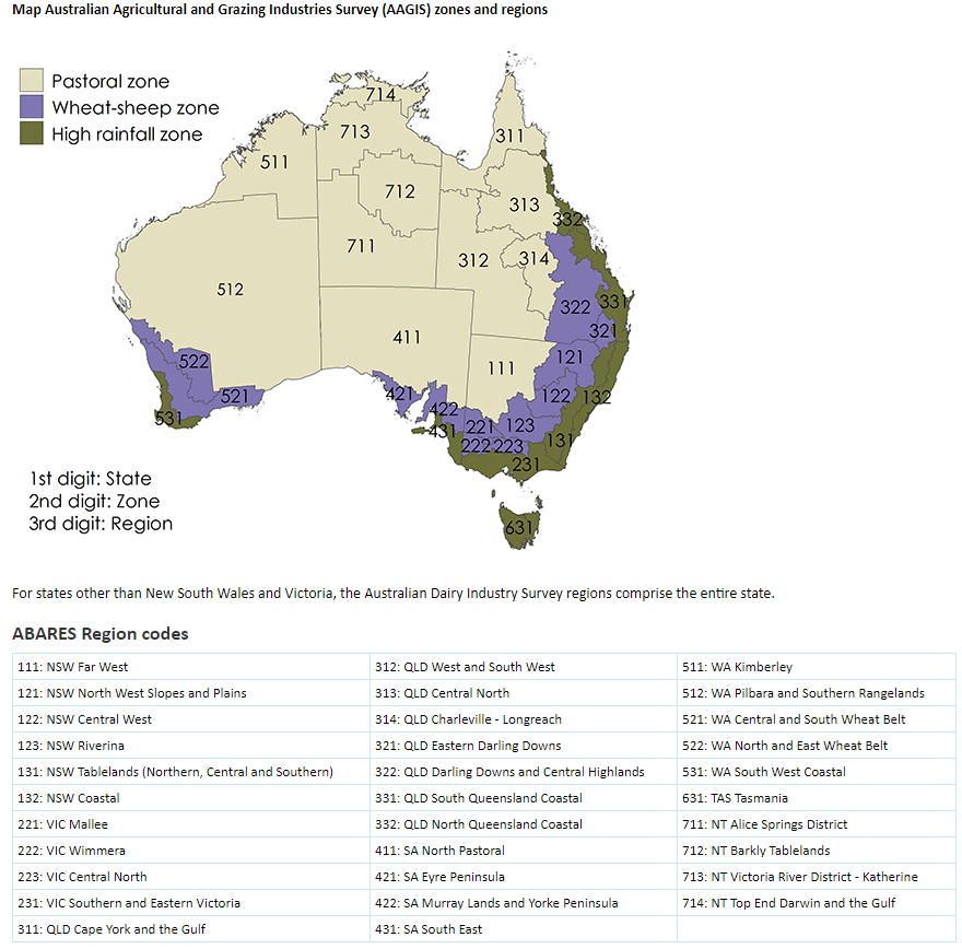
- ^ ABARESb (2020). "Map Australian Agricultural and Grazing Industries Survey (AAGIS) zones and regions". Australian Bureau of Agricultural and Resource Economics and Sciences. Retrieved October 12, 2020.
File history
Click on a date/time to view the file as it appeared at that time.
| Date/Time | Thumbnail | Dimensions | User | Comment | |
|---|---|---|---|---|---|
| current | 00:31, 4 November 2020 | | 880 × 868 (170 KB) | Floralturnip0 (talk | contribs) | <ref>{{cite web |url=https://www.agriculture.gov.au/abares/research-topics/surveys/farm-definitions-methods#regions |title=Map Australian Agricultural and Grazing Industries Survey (AAGIS) zones and regions |last=ABARESb |date=2020 |website=Australian Bureau of Agricultural and Resource Economics and Sciences |access-date=October 12, 2020}}</ref> |
You cannot overwrite this file.
File usage
The following file is a duplicate of this file (more details):
- File:AAGIS zones.png from Commons
The following pages on the English Wikipedia use this file (pages on other projects are not listed):