Size of this preview: 800 × 593 pixels. Other resolutions: 320 × 237 pixels | 640 × 475 pixels | 1,024 × 760 pixels | 1,280 × 950 pixels | 2,239 × 1,661 pixels.
Original file (2,239 × 1,661 pixels, file size: 907 KB, MIME type: image/jpeg)
| This is a file from the Wikimedia Commons. Information from its description page there is shown below. Commons is a freely licensed media file repository. You can help. |
Summary
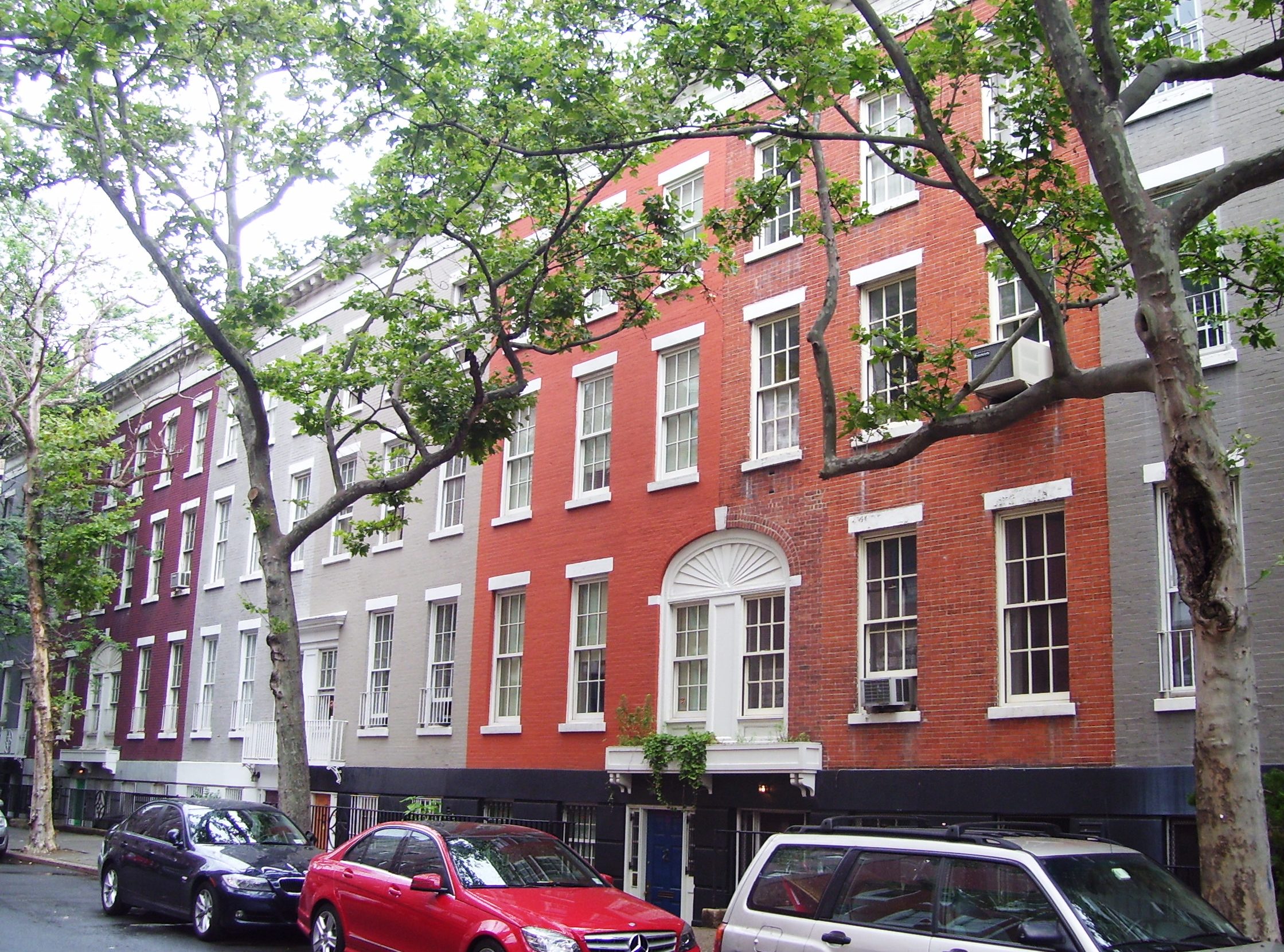
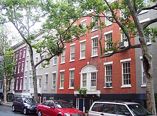
| Description | 82 (right)- 96 (left) MacDougal Street, between Houston and Bleecker Streets in the South Village neighborhood of Manhattan, New York City, is part of the MacDougal-Sullivan Gardens Historic District which was designated a New York City landmark in 1967 and added to the National Register of Historic Places in 1983. The district includes 74-96 MacDougal Street and 170-188 Sullivan Street. The 22 houses were built between 1844 (MacDougal Street) and 1850 (Sullivan Street) in the Greek Revival style, but became dilapidated until they were bought by William Sloane Coffin in 1920 and throughly renovated by Francis Y. Joannes and Maxwell Hyde in Colonial Revival style, with the rear yards combined to make a common garden. (Sources: Guide to NYC Landmarks (4th ed.) and NYCLPC MacDougal-Sullivan Gardens Historic District Designation Report") |
| Date | |
| Source | Own work |
| Author | Beyond My Ken |
| Camera location | | View this and other nearby images on: OpenStreetMap |
|---|
Licensing
I, the copyright holder of this work, hereby publish it under the following licenses:

|
Permission is granted to copy, distribute and/or modify this document under the terms of the GNU Free Documentation License, Version 1.2 or any later version published by the Free Software Foundation; with no Invariant Sections, no Front-Cover Texts, and no Back-Cover Texts. A copy of the license is included in the section entitled GNU Free Documentation License. |
This file is licensed under the Creative Commons Attribution-Share Alike Attribution-Share Alike 4.0 International, 3.0 Unported, 2.5 Generic, 2.0 Generic and 1.0 Generic license.
- You are free:
- to share – to copy, distribute and transmit the work
- to remix – to adapt the work
- Under the following conditions:
- attribution – You must give appropriate credit, provide a link to the license, and indicate if changes were made. You may do so in any reasonable manner, but not in any way that suggests the licensor endorses you or your use.
- share alike – If you remix, transform, or build upon the material, you must distribute your contributions under the same or compatible license as the original.
You may select the license of your choice.
File history
Click on a date/time to view the file as it appeared at that time.
| Date/Time | Thumbnail | Dimensions | User | Comment | |
|---|---|---|---|---|---|
| current | 05:09, 2 July 2011 | | 2,239 × 1,661 (907 KB) | Beyond My Ken | {{Information |Description= 82 (right)- 96 (left) MacDougal Street, between Houston and Bleecker Streets in the South Village neighborhood of Manhattan, New York City, is part of the MacDougal-Sullivan Gardens Historic District which was designated a New |
File usage
The following pages on the English Wikipedia use this file (pages on other projects are not listed):
Global file usage
The following other wikis use this file:
- Usage on ceb.wikipedia.org
- Usage on de.wikipedia.org
- Usage on pt.wikipedia.org
- Usage on www.wikidata.org
- Usage on zh.wikipedia.org