
Size of this preview: 776 × 600 pixels. Other resolutions: 311 × 240 pixels | 621 × 480 pixels | 994 × 768 pixels | 1,280 × 989 pixels | 2,560 × 1,978 pixels | 3,300 × 2,550 pixels.
Original file (3,300 × 2,550 pixels, file size: 1.21 MB, MIME type: image/png)
| This is a file from the Wikimedia Commons. Information from its description page there is shown below. Commons is a freely licensed media file repository. You can help. |
| Description |
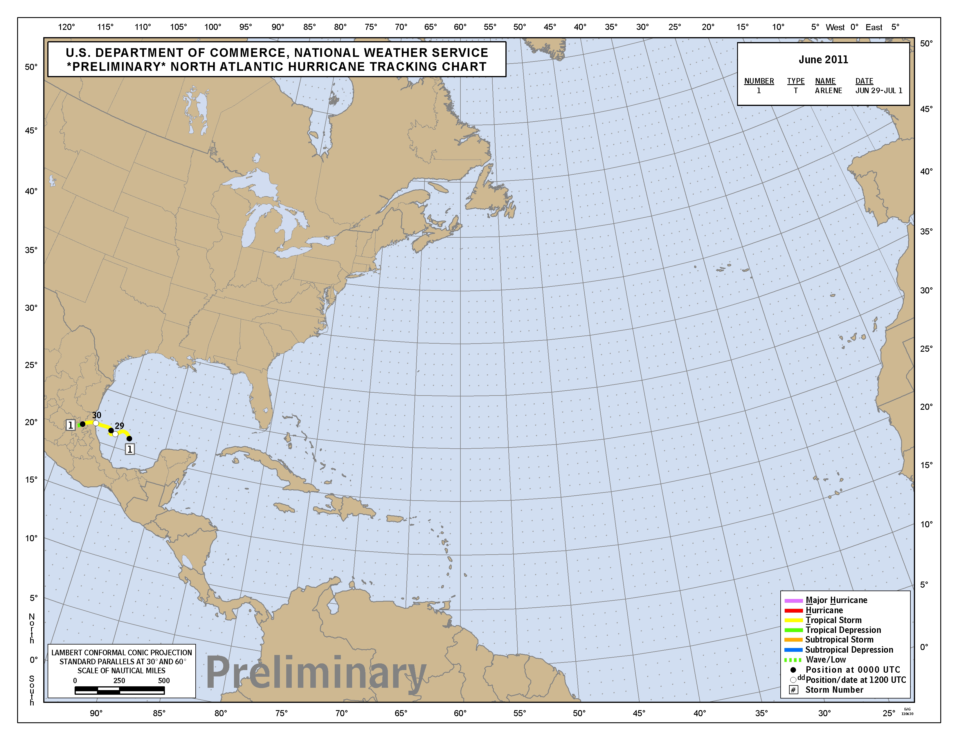
English: A preliminary track map of the 2011 Atlantic hurricane season. |
|||
| Date | ||||
| Source | http://www.nhc.noaa.gov/archive/2011/tws/graphics/prelimTrack_atlc_201106.png | |||
| Author | National Hurricane Center | |||
| Permission (Reusing this file) |
|
File history
Click on a date/time to view the file as it appeared at that time.
| Date/Time | Thumbnail | Dimensions | User | Comment | |
|---|---|---|---|---|---|
| current | 00:28, 25 September 2016 | | 3,300 × 2,550 (1.21 MB) | Cmdrjameson | Compressed with pngout. Reduced by 429kB (25% decrease). |
| 18:18, 1 July 2011 |  | 3,300 × 2,550 (1.63 MB) | Hurricanefan25 | {{Information |Description ={{en|1=A preliminary track map of the 2011 Atlantic hurricane season.}} |Source =http://www.nhc.noaa.gov/archive/2011/tws/graphics/prelimTrack_atlc_201106.png |Author =National Hurricane Center |Date |
File usage
The following pages on the English Wikipedia use this file (pages on other projects are not listed):