Size of this preview: 800 × 532 pixels. Other resolutions: 320 × 213 pixels | 640 × 426 pixels | 1,024 × 681 pixels | 1,440 × 958 pixels.
Original file (1,440 × 958 pixels, file size: 204 KB, MIME type: image/jpeg)
| This is a file from the Wikimedia Commons. Information from its description page there is shown below. Commons is a freely licensed media file repository. You can help. |
Summary
| Description |
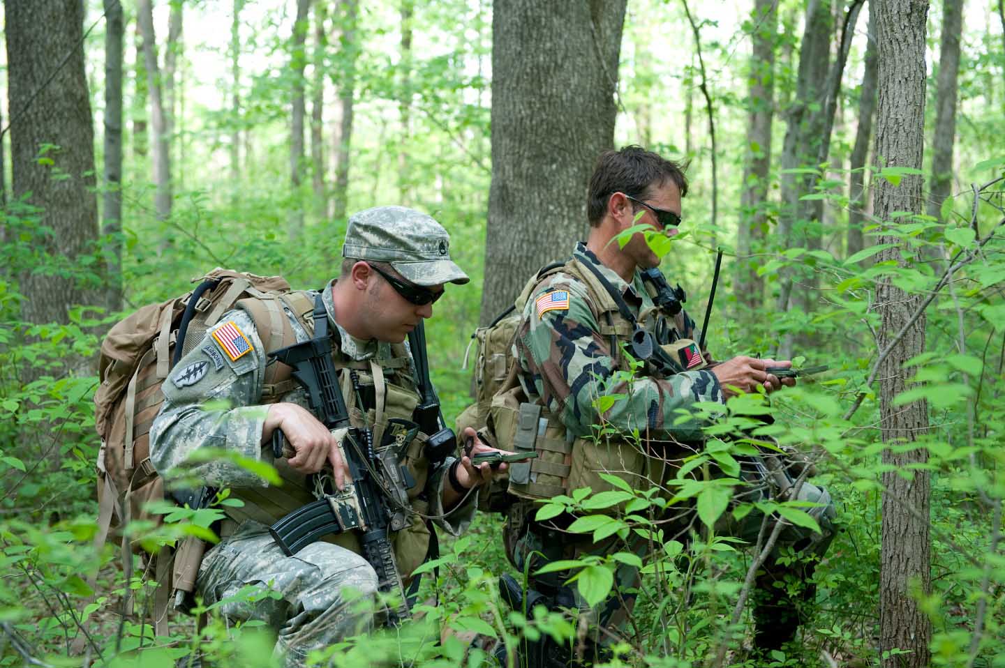
English: Soldiers with 2nd Battalion, 19th Special Forces Group check their course with compasses during a foot patrol while training at Camp Atterbury Joint Maneuver Training Center, Ind., May 12. Despite the advent of GPS navigational technology, which these soldiers do utilize, the lensatic compass remains the most reliable tool for land navigation. |
| Date | |
| Source | http://www.soc.mil/UNS/Photo/2011/2011/album/slides/402774.html |
| Author | United States Army |
Licensing
This work is in the public domain in the United States because it is a work prepared by an officer or employee of the United States Government as part of that person’s official duties under the terms of Title 17, Chapter 1, Section 105 of the US Code.
Note: This only applies to original works of the Federal Government and not to the work of any individual U.S. state, territory, commonwealth, county, municipality, or any other subdivision. This template also does not apply to postage stamp designs published by the United States Postal Service since 1978. (See § 313.6(C)(1) of Compendium of U.S. Copyright Office Practices). It also does not apply to certain US coins; see The US Mint Terms of Use.
|
 | |
| This file has been identified as being free of known restrictions under copyright law, including all related and neighboring rights. | ||
File history
Click on a date/time to view the file as it appeared at that time.
| Date/Time | Thumbnail | Dimensions | User | Comment | |
|---|---|---|---|---|---|
| current | 00:22, 22 June 2011 | | 1,440 × 958 (204 KB) | TomPointTwo~commonswiki |
File usage
The following pages on the English Wikipedia use this file (pages on other projects are not listed):
Global file usage
The following other wikis use this file:
- Usage on ru.wikipedia.org
- Usage on zh.wikipedia.org