Size of this preview: 602 × 599 pixels. Other resolutions: 241 × 240 pixels | 482 × 480 pixels | 772 × 768 pixels | 1,029 × 1,024 pixels | 2,058 × 2,048 pixels.
Original file (2,058 × 2,048 pixels, file size: 888 KB, MIME type: image/jpeg)
| This is a file from the Wikimedia Commons. Information from its description page there is shown below. Commons is a freely licensed media file repository. You can help. |
Summary
| Description |
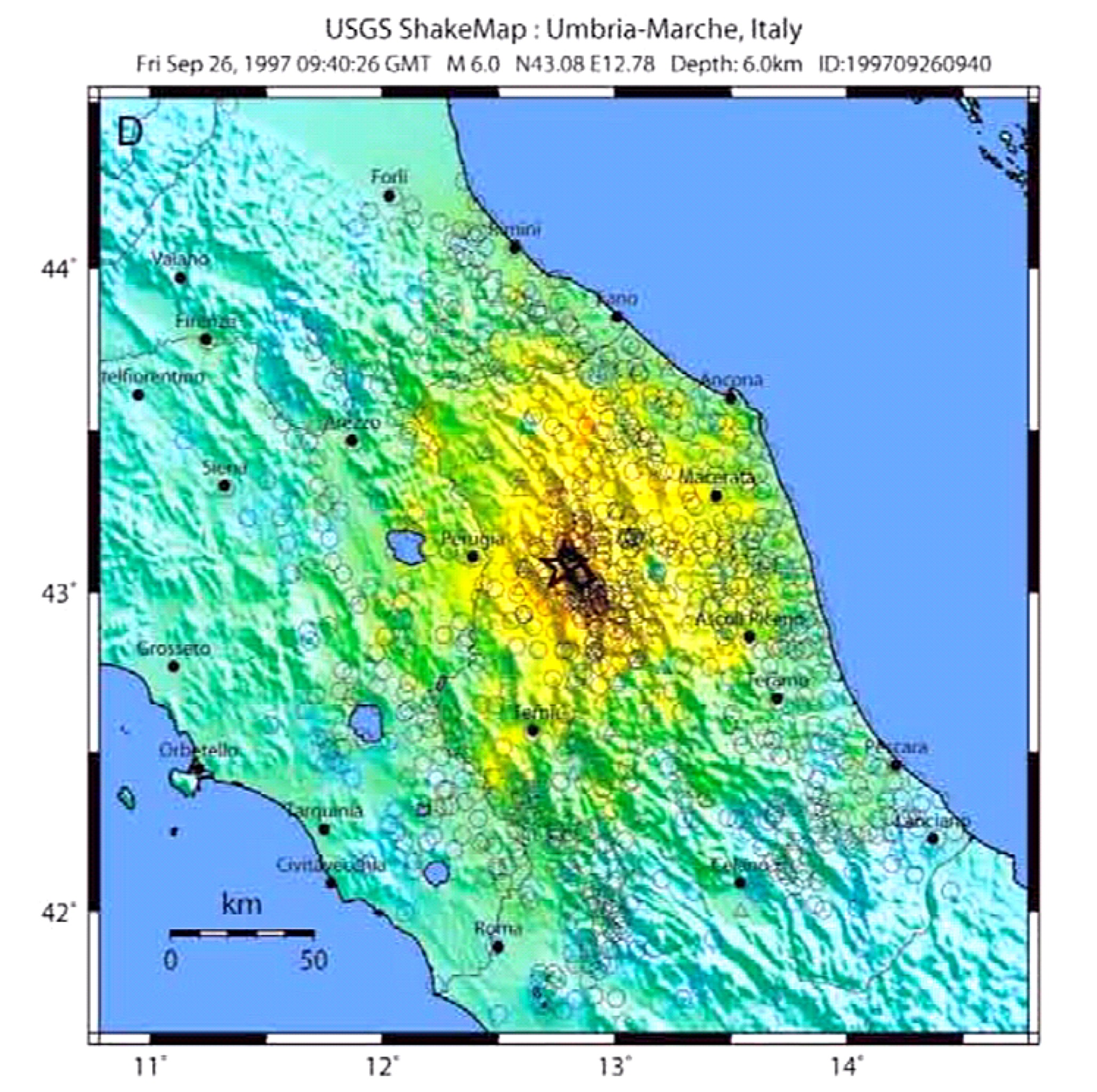
English: Map of the intensity of the Umbria and Marche earthquake of September 26, 1997
Italiano: Mappa dell'intensità del terremoto di Umbria e Marche del 26 settembre 1997 |
| Date | |
| Source | https://pubs.usgs.gov/of/2008/1236/downloads/OF08-1236_508.pdf |
| Author | USGS |
Licensing
This image is in the public domain in the United States because it only contains materials that originally came from the United States Geological Survey, an agency of the United States Department of the Interior. For more information, see the official USGS copyright policy.
|
File history
Click on a date/time to view the file as it appeared at that time.
| Date/Time | Thumbnail | Dimensions | User | Comment | |
|---|---|---|---|---|---|
| current | 11:12, 18 April 2019 | | 2,058 × 2,048 (888 KB) | Lrt000 | {{Information |description ={{en|1=Map of the intensity of the Umbria and Marche earthquake of September 26, 1997}} {{it|1=Mappa dell'intensità del terremoto di Umbria e Marche del 26 settembre 1997}} |date =2019-04-18 |source =https://pubs.usgs.gov/of/2008/1236/downloads/OF08-1236_508.pdf |author =USGS }} |
File usage
The following pages on the English Wikipedia use this file (pages on other projects are not listed):
Global file usage
The following other wikis use this file:
- Usage on fr.wikipedia.org
- Usage on it.wikipedia.org