
Size of this preview: 593 × 599 pixels. Other resolutions: 237 × 240 pixels | 475 × 480 pixels | 760 × 768 pixels | 1,013 × 1,024 pixels | 2,027 × 2,048 pixels | 3,317 × 3,352 pixels.
Original file (3,317 × 3,352 pixels, file size: 1.45 MB, MIME type: image/jpeg)
| This is a file from the Wikimedia Commons. Information from its description page there is shown below. Commons is a freely licensed media file repository. You can help. |
Summary
| Description |
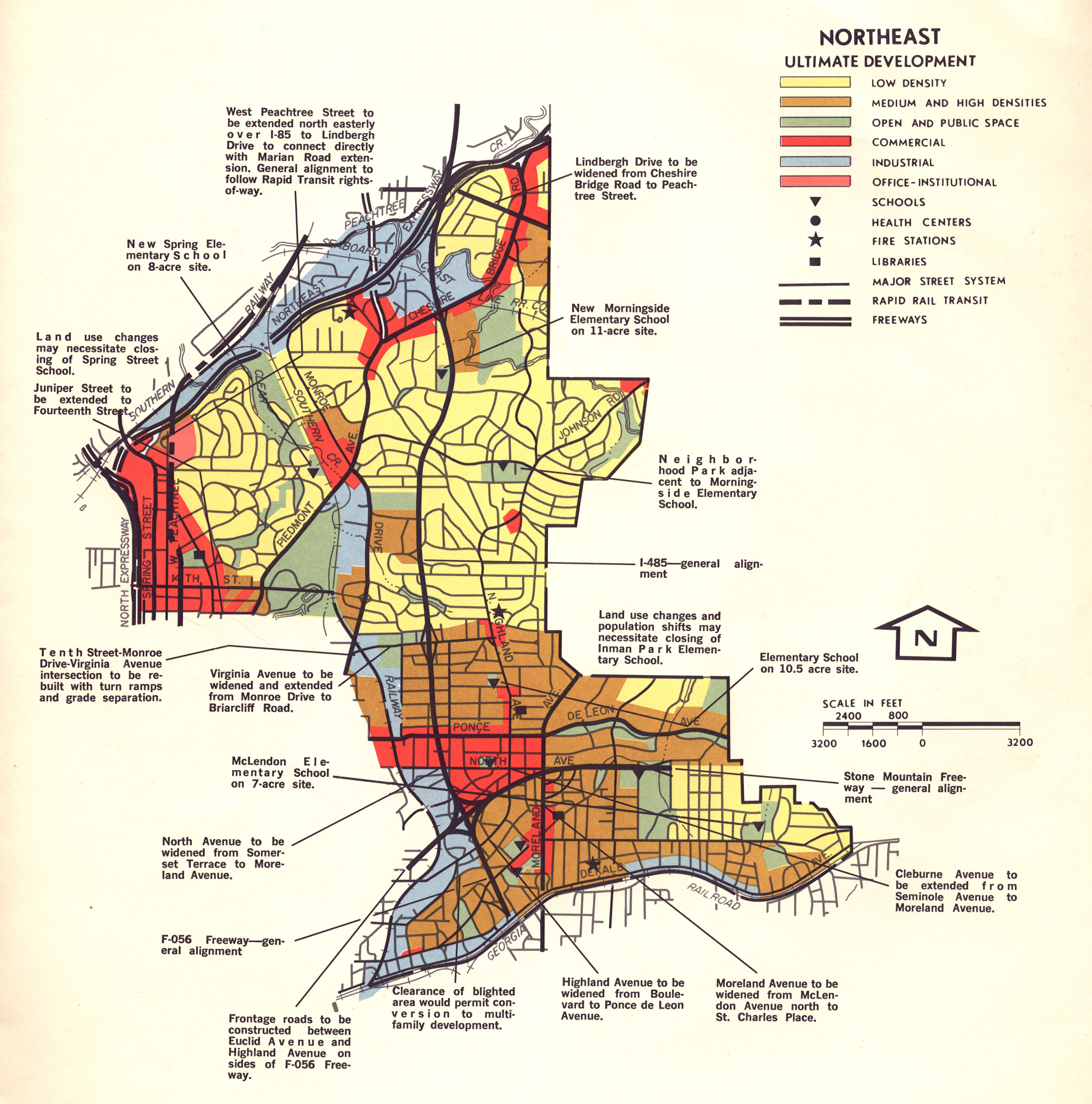
English: Proposed route of I-485 through northeastern part of the City of Atlanta in 1970. |
| Date | |
| Source | http://vahi.org/wp-content/uploads/2012/04/1970_I-485-map.jpg |
| Author | Georgia Dept of Transportation |
Licensing
This work is in the public domain in the United States because it was published in the United States between 1929 and 1977, inclusive, without a copyright notice. For further explanation, see Commons:Hirtle chart as well as a detailed definition of "publication" for public art. Note that it may still be copyrighted in jurisdictions that do not apply the rule of the shorter term for US works (depending on the date of the author's death), such as Canada (50 p.m.a.), Mainland China (50 p.m.a., not Hong Kong or Macao), Germany (70 p.m.a.), Mexico (100 p.m.a.), Switzerland (70 p.m.a.), and other countries with individual treaties.
|
 |
File history
Click on a date/time to view the file as it appeared at that time.
| Date/Time | Thumbnail | Dimensions | User | Comment | |
|---|---|---|---|---|---|
| current | 15:44, 24 April 2012 | | 3,317 × 3,352 (1.45 MB) | Keizers |
File usage
The following pages on the English Wikipedia use this file (pages on other projects are not listed):
Global file usage
The following other wikis use this file:
- Usage on fi.wikipedia.org
- Usage on www.wikidata.org