Size of this preview: 623 × 600 pixels. Other resolutions: 249 × 240 pixels | 499 × 480 pixels | 798 × 768 pixels | 1,064 × 1,024 pixels | 1,346 × 1,296 pixels.
Original file (1,346 × 1,296 pixels, file size: 791 KB, MIME type: image/jpeg)
| This is a file from the Wikimedia Commons. Information from its description page there is shown below. Commons is a freely licensed media file repository. You can help. |
Summary
| Description |
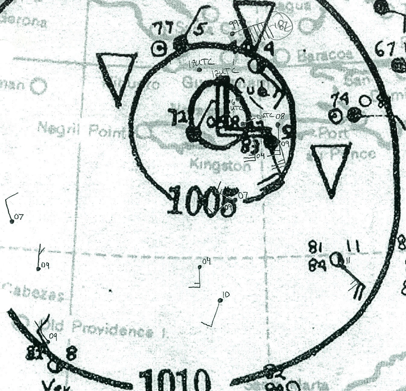
English: Surface weather map of Hurricane 6 of the 1935 Atlantic hurricane season on October 22, 1935. The storm is centered between Jamaica and Cuba. |
| Date | |
| Source | http://www.aoml.noaa.gov/hrd/hurdat/weathermaps/ |
| Author | National Oceanic and Atmospheric Administration |
Licensing
This image is in the public domain because it contains materials that originally came from the U.S. National Oceanic and Atmospheric Administration, taken or made as part of an employee's official duties.
|
File history
Click on a date/time to view the file as it appeared at that time.
| Date/Time | Thumbnail | Dimensions | User | Comment | |
|---|---|---|---|---|---|
| current | 20:17, 16 June 2014 | | 1,346 × 1,296 (791 KB) | Juliancolton | User created page with UploadWizard |
File usage
The following pages on the English Wikipedia use this file (pages on other projects are not listed):