
Size of this PNG preview of this SVG file: 512 × 381 pixels. Other resolutions: 320 × 238 pixels | 640 × 476 pixels | 1,024 × 762 pixels | 1,280 × 953 pixels | 2,560 × 1,905 pixels.
Original file (SVG file, nominally 512 × 381 pixels, file size: 214 KB)
| This is a file from the Wikimedia Commons. Information from its description page there is shown below. Commons is a freely licensed media file repository. You can help. |
Summary
| Description |
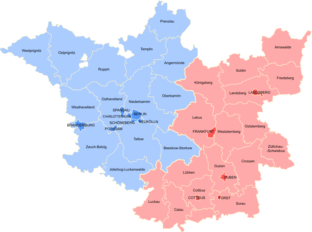
English: Stadtkreise and Kreise of the Province of Brandenburg. Blue indicates the Regierungsbezirk Potsdam, and Red indicates Regierungsbezirk Frankfurt. |
| Date | |
| Source | |
| Author |
Licensing
This file is licensed under the Creative Commons Attribution-Share Alike 3.0 Unported license.
- You are free:
- to share – to copy, distribute and transmit the work
- to remix – to adapt the work
- Under the following conditions:
- attribution – You must give appropriate credit, provide a link to the license, and indicate if changes were made. You may do so in any reasonable manner, but not in any way that suggests the licensor endorses you or your use.
- share alike – If you remix, transform, or build upon the material, you must distribute your contributions under the same or compatible license as the original.
File history
Click on a date/time to view the file as it appeared at that time.
| Date/Time | Thumbnail | Dimensions | User | Comment | |
|---|---|---|---|---|---|
| current | 14:57, 13 October 2021 | | 512 × 381 (214 KB) | MsCosmicAsh | Outlined text |
| 14:52, 13 October 2021 |  | 512 × 381 (82 KB) | MsCosmicAsh | Uploaded a work by User:Qqerim from This image is a derivative work of the following images: Province_of_Brandenburg_Kingdom_of_Prussia,_1905,_Administrative_Map.png with UploadWizard |
File usage
The following pages on the English Wikipedia use this file (pages on other projects are not listed):