Size of this preview: 639 × 600 pixels. Other resolutions: 256 × 240 pixels | 511 × 480 pixels | 818 × 768 pixels | 1,091 × 1,024 pixels | 2,181 × 2,048 pixels | 2,946 × 2,766 pixels.
Original file (2,946 × 2,766 pixels, file size: 1.09 MB, MIME type: image/jpeg)
| This is a file from the Wikimedia Commons. Information from its description page there is shown below. Commons is a freely licensed media file repository. You can help. |
Summary
| Description |
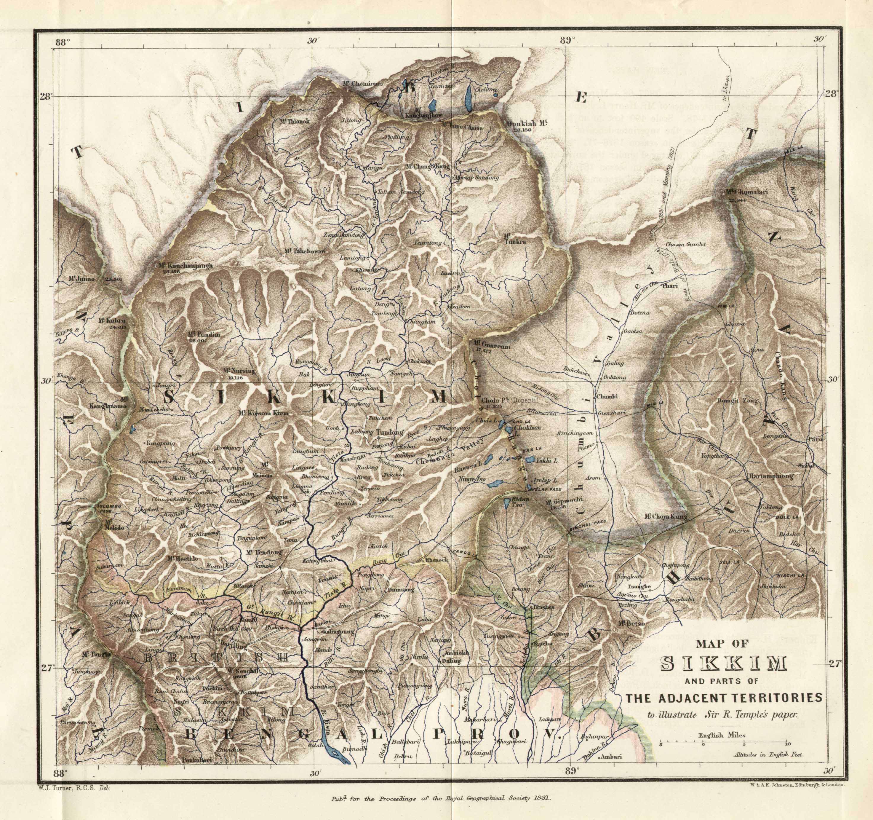
English: 1881 Map of Sikkim published with a paper by Sir Richard Temple in the Journal of Royal Geographical Society, 1881.
British India's border with Sikkim and Bhutan shows the Darjeeling and Kalimpong districts acquired from those states. The trade route between Kalimpong and the Chumbi Valley via Jelep La is also shown. |
| Date | |
| Source | www.pahar.in |
| Author | W. J. Turner, RGS (W. & A. K. Johnston, Edinburgh & London) |
Licensing
|
This work is in the public domain in its country of origin and other countries and areas where the copyright term is the author's life plus 70 years or fewer. This work is in the public domain in the United States because it was published (or registered with the U.S. Copyright Office) before January 1, 1929. | |
| This file has been identified as being free of known restrictions under copyright law, including all related and neighboring rights. | |
File history
Click on a date/time to view the file as it appeared at that time.
| Date/Time | Thumbnail | Dimensions | User | Comment | |
|---|---|---|---|---|---|
| current | 20:48, 2 August 2021 | | 2,946 × 2,766 (1.09 MB) | Kautilya3 | Uploaded a work by Sir Richard Temple from www.pahar.in with UploadWizard |
File usage
The following pages on the English Wikipedia use this file (pages on other projects are not listed):