File:1861 U.S. Coast Survey Map of New York City Bay and Harbor - Geographicus - NewYorkBayHarbor4-uscs-1861.jpg
Original file (5,000 × 5,682 pixels, file size: 5.3 MB, MIME type: image/jpeg)
| This is a file from the Wikimedia Commons. Information from its description page there is shown below. Commons is a freely licensed media file repository. You can help. |
| Coast Chart No. 21, New York Bay and Harbor, New York | ||||||
|---|---|---|---|---|---|---|
| Artist | ||||||
| Title |
Coast Chart No. 21, New York Bay and Harbor, New York |
|||||
| Description |
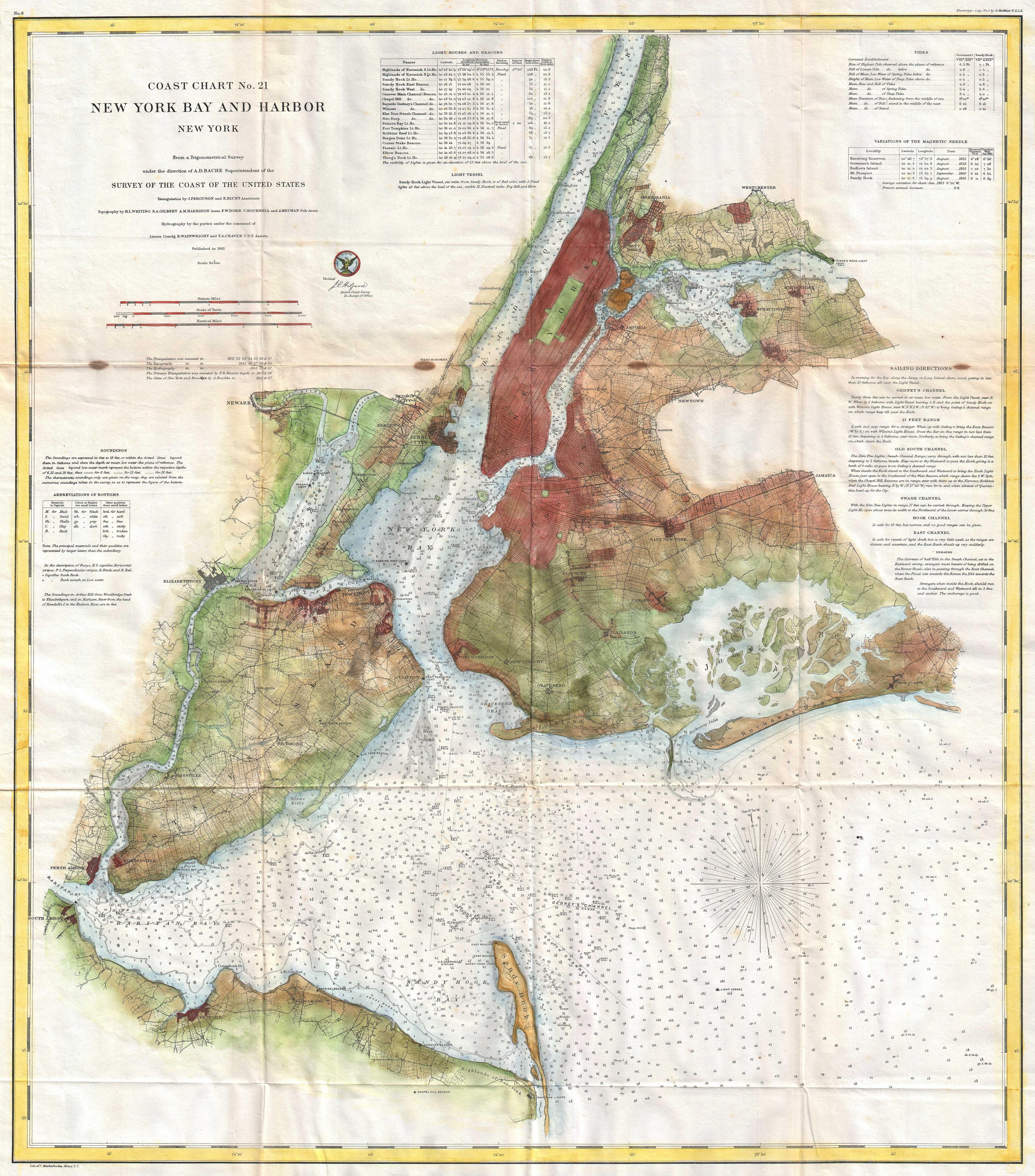
English: A rare 1861 costal chart of New York City, it’s harbor, and environs. One of the first 19th century carts to depicts New York City as we know it today, including Manhattan, Queens, Brooklyn, the Bronx and Staten Island. Also includes Jersey City, Newark and Hoboken. This is a mid-point chart in the development of this particular series. In-land details are not as comprehensive as in later charts, most particularly the 1866 series, however remains quite thorough especially with regard to developing towns and communities. In addition to inland details, this chart contains a wealth of practical information for the mariner from oceanic depths, to harbors and navigation tips on important channels. Map also includes tables of light houses and beacons, tides and magnetic declination as well as detailed sailing instructions. The triangulation for this chart was prepared by J. Ferguson and E. Blunt. The topography by H. L. Whiting, S. A. Gilbert, A. M Harrison, F. W. Door, C. Rockwell and J. M E. Chan. The hydrography was accomplished by R. Wainwright and T. A. Craven. The entire production was supervised by A. D. Bache, Superintendent of the Survey of the Coast of the United States and one of the most influential American cartographers of the 19th century. |
|||||
| Date | 1861 (dated) | |||||
| Dimensions | height: 27 in (68.5 cm); width: 32 in (81.2 cm) | |||||
| Accession number |
Geographicus link: NewYorkBayHarbor4-uscs-1861 |
|||||
| Source/Photographer |
Report of the Superintendant of the U.S. Coast Survey, (1861 edition).
|
|||||
| Permission (Reusing this file) |
|
|||||
File history
Click on a date/time to view the file as it appeared at that time.
| Date/Time | Thumbnail | Dimensions | User | Comment | |
|---|---|---|---|---|---|
| current | 09:14, 19 March 2011 | | 5,000 × 5,682 (5.3 MB) | BotMultichill | {{subst:User:Multichill/Geographicus |link=http://www.geographicus.com/P/AntiqueMap/NewYorkBayHarbor4-uscs-1861 |product_name=1861 U.S. Coast Survey Map of New York City Bay and Harbor |map_title=Coast Chart No. 21, New York Bay and Harbor, New York |de |