Size of this preview: 800 × 600 pixels. Other resolutions: 320 × 240 pixels | 640 × 480 pixels | 1,024 × 768 pixels | 1,280 × 960 pixels | 2,560 × 1,920 pixels | 3,456 × 2,592 pixels.
Original file (3,456 × 2,592 pixels, file size: 7.03 MB, MIME type: image/jpeg)
| This is a file from the Wikimedia Commons. Information from its description page there is shown below. Commons is a freely licensed media file repository. You can help. |
Summary
| Description |
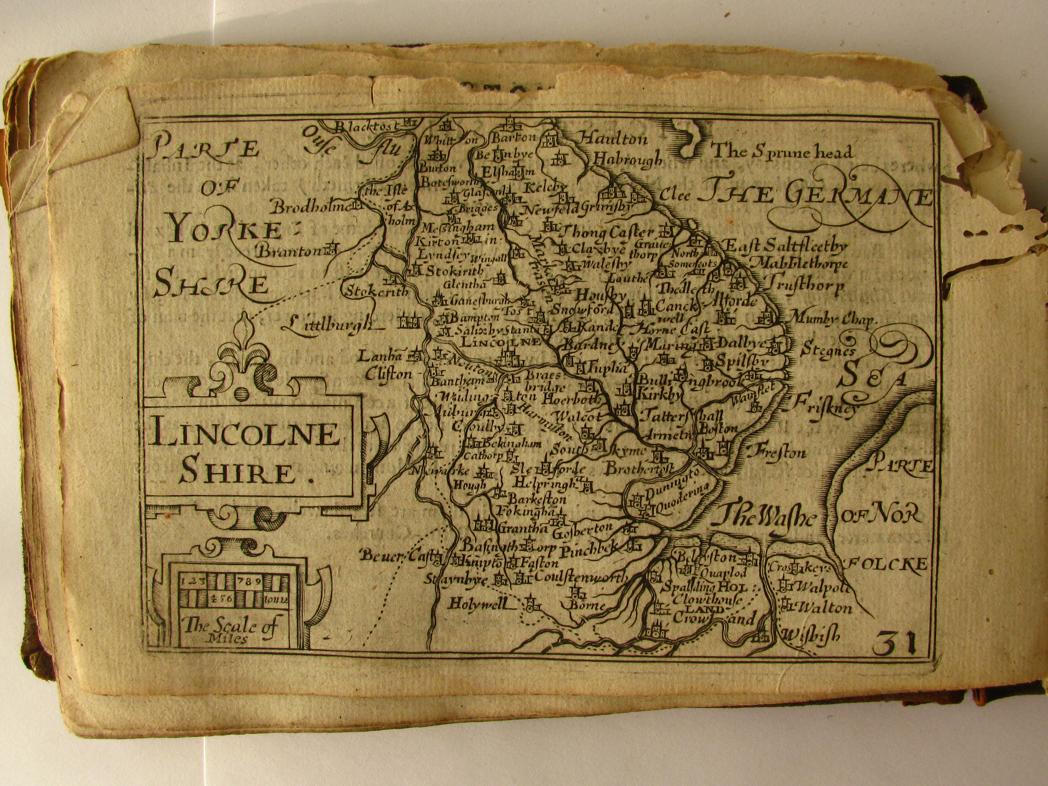
English: Map from the 1627 "Miniature Speed Atlas" of England, Scotland, Ireland and Wales, with maps by Pieter van den Keere. Photograph taken by me, the atlas owned by me |
| Date | |
| Source | Own work |
| Author | Seriykotik |
| Permission (Reusing this file) |
public domain |
Licensing
| I, the copyright holder of this work, release this work into the public domain. This applies worldwide. In some countries this may not be legally possible; if so: I grant anyone the right to use this work for any purpose, without any conditions, unless such conditions are required by law. |
File history
Click on a date/time to view the file as it appeared at that time.
| Date/Time | Thumbnail | Dimensions | User | Comment | |
|---|---|---|---|---|---|
| current | 01:47, 21 January 2013 | | 3,456 × 2,592 (7.03 MB) | Slick-o-bot | Bot: convert to a non-interlaced jpeg image (see bugzilla:17645) |
| 16:48, 3 May 2010 |  | 3,456 × 2,592 (6.61 MB) | Seriykotik | {{Information |Description={{en|1=Map from the 1627 "Miniature Speed Atlas" of England Sotland Ireland and Wales, with maps by Pieter van den Keere Photograph taken mby me, the atlas owned by me}} |Source={{own}} |Author=Seriykotik |Da |
File usage
The following pages on the English Wikipedia use this file (pages on other projects are not listed):
Global file usage
The following other wikis use this file:
- Usage on pl.wikipedia.org