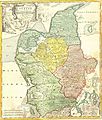
File:1710 Homann Map of Denmark "Iutiae" - Geographicus - Iutiae-homann-1710.jpg

Original file(2,500 × 2,935 pixels, file size: 2.42 MB, MIME type: image/jpeg)

Johann Homann: Tabula Generalis Iutiae   (Wikidata search (Cirrus search) Wikidata query (SPARQL)  Create new Wikidata item based on this file)
Artist
Johann Homann  (1664–1724)  wikidata:Q62706
 
Johann Homann
Alternative names
Johann Baptist Homann; Ioannis Baptista Homann; Johann-Baptista Homann; Johann Baptista Homann
Description German cartographer, publisher and copperplate engraver
Date of birth/death 20 March 1664 Edit this at Wikidata 1 July 1724 Edit this at Wikidata
Location of birth/death Kammlach Nuremberg
Work location
Authority file
artist QS:P170,Q62706
Title
Tabula Generalis Iutiae
Description
English: This is a historically important and spectacular 1710 Homann map part of Denmark. Formally titled Tabula Generalis Iutiae. Features a decorative title cartouche including Poseidon and others. Johann Baptist Homann (1663-1724), his son, Christoph Homann (1703-30) founded 18th century's most important German cartography firm around 1702 in Nurnburg. Six years after his father's 1724 death, Christoph retired from the map business on the condition that all future maps produced by the firm be published under the name of Homann Heirs.
Date 1710
date QS:P571,+1710-00-00T00:00:00Z/9
Dimensions height: 20 in (50.8 cm); width: 23 in (58.4 cm)
dimensions QS:P2048,20U218593
dimensions QS:P2049,23U218593
Accession number
Geographicus link: Iutiae-homann-1710
Source/Photographer
Permission
(Reusing this file)
This is a faithful photographic reproduction of a two-dimensional, public domain work of art. The work of art itself is in the public domain for the following reason:
Public domain

This work is in the public domain in its country of origin and other countries and areas where the copyright term is the author's life plus 100 years or fewer.


You must also include a United States public domain tag to indicate why this work is in the public domain in the United States.
The official position taken by the Wikimedia Foundation is that "faithful reproductions of two-dimensional public domain works of art are public domain".
This photographic reproduction is therefore also considered to be in the public domain in the United States. In other jurisdictions, re-use of this content may be restricted; see Reuse of PD-Art photographs for details.

Captions

Add a one-line explanation of what this file represents

Items portrayed in this file

depicts

image/jpeg

8e4b9f1a2036dba4816a2399967ad36eadc797e7

2,540,253 byte

2,935 pixel

2,500 pixel

File history

Click on a date/time to view the file as it appeared at that time.

Date/TimeThumbnailDimensionsUserComment
current19:01, 24 March 2011Thumbnail for version as of 19:01, 24 March 20112,500 × 2,935 (2.42 MB)BotMultichillT{{subst:User:Multichill/Geographicus |link=http://www.geographicus.com/P/AntiqueMap/Iutiae-homann-1710 |product_name=1710 Homann Map of Denmark "Iutiae" |map_title=Tabula Generalis Iutiae |description=This is a historically important and spectacular 1710
The following pages on the English Wikipedia use this file (pages on other projects are not listed):

Global file usage

The following other wikis use this file: