al-Humānīya, also called al-Humayniyah, is a historical town in Iraq, on the Tigris.[1] Of probable Sasanian origin, Humaniya was a large regional town of medieval Iraq, mentioned by several contemporary authors.[2]
Humānīya
Humayniyah | |
|---|---|
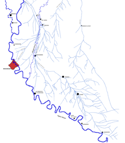
 Map showing Humaniya in relation to other medieval Iraqi sites | |
| Coordinates: near 32°50′38″N 45°04′36″E / 32.84389°N 45.07667°E | |
| Country | Iraq |
| Governorate | Wasit |
After the caliph al-Amin, died, his mother, Zubaydah, and his two sons were imprisoned in Humaniya on the orders of al-Ma'mun.[1] In the early 1200s, Yaqut al-Hamawi described it as a village the size of a city,[2] surrounded by extensive farmland.[2] This suggests that Humaniya may have expanded during the late Abbasid period, even while most towns in the area were shrinking or becoming abandoned altogether.[2]
Archaeological evidence indicates that Humaniya was one of a relatively small number of permanent settlements in the region to remain occupied during the Ilkhanid period,[2] when settled agriculture was dramatically reduced throughout Iraq.[2] One or more minarets were still standing here when Felix Jones surveyed the area of the Nahrawan Canal in the mid-1800s,[2] and Guy Le Strange noted that Humaniya was "still found on the map" around the turn of the 20th century.[1]
Historically, Humaniya was on the right, or south, bank of the Tigris, but the oxbow loop it lay on became cut off in the late 19th century,[2] and it is now on the left/north bank.[3]
References
edit- ^ a b c Le Strange, Guy (1905). The Lands of the Eastern Caliphate: Mesopotamia, Persia, and Central Asia, from the Moslem Conquest to the Time of Timur. Cambridge: Cambridge University Press. p. 37. OCLC 458169031.
- ^ a b c d e f g h Adams, Robert M. (1965). Land Behind Baghdad: A History of Settlement on the Diyala Plains. Chicago and London: University of Chicago Press. pp. 72, 91, 107, 110–11. OCLC 899942882.
- ^ Adams, Robert M. (1981). Heartland of Cities. Chicago and London: University of Chicago Press. p. 197. OCLC 466530493.
