Talk:Aegean Region
| This is the talk page for discussing improvements to the Aegean Region article. This is not a forum for general discussion of the article's subject. |
Article policies
|
| Find sources: Google (books · news · scholar · free images · WP refs) · FENS · JSTOR · TWL |
| This article is rated Start-class on Wikipedia's content assessment scale. It is of interest to the following WikiProjects: | |||||||||||
| |||||||||||


Comments
editSorry about the two roll-backs, I misread what was written there ZBrannigan 09:32, 25 March 2007 (UTC)
Map
editMaps are wrong. —Preceding unsigned comment added by 85.107.104.41 (talk) 21:48, 9 November 2008 (UTC)
Look at Turkish page of Aegean region. That map is true one and for example in balıkesir page, you say burhaniye, ayvalık.... in aegean region. However if you look their pages, some of them were shown like in marmara region. in your map show, if centrum of province in X region. All province were shown like in X region, but province's other part can be inY region. —Preceding unsigned comment added by 85.107.104.41 (talk) 22:09, 9 November 2008 (UTC)
http://www.cografya.gen.tr/egitim/bolgeler/marmara.jpg http://www.cografya.gen.tr/egitim/bolgeler/karadeniz.jpg http://www.cografya.gen.tr/egitim/bolgeler/ege.jpg http://www.cografya.gen.tr/egitim/bolgeler/icanadolu.jpg http://www.cografya.gen.tr/egitim/bolgeler/akdeniz.jpg http://www.cografya.gen.tr/egitim/bolgeler/doguanadolu.jpg http://www.cografya.gen.tr/egitim/bolgeler/guneydogu.jpg
http://www.cografyakulubu.com/image/harita/turkiye/10bölgeler.jpg http://ansiklopedi.turkcebilgi.com/images/imgk/tr_cografi_bolgeler.jpg http://www.bakisyayin.com/türkiye%20coğrafi%20bölgeler%20haritası(70-100).jpg
in Turkey, this region system don't like american, english or german system. it is only about climate. Thanks (turkish, teşekkürler) —Preceding unsigned comment added by 85.107.104.41 (talk) 22:51, 9 November 2008 (UTC)
I'm Turk and i live in Aegean Region. —Preceding unsigned comment added by 88.227.3.239 (talk) 12:01, 11 March 2009 (UTC)
Turkiyenin cografi bolgeleri.gif This is real map.--Ollios (talk) 17:47, 2 October 2009 (UTC)
Major changes/corrections
editMaps
editRight now, these maps are used in the article:


.jpg)
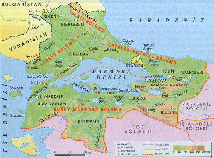
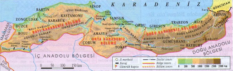
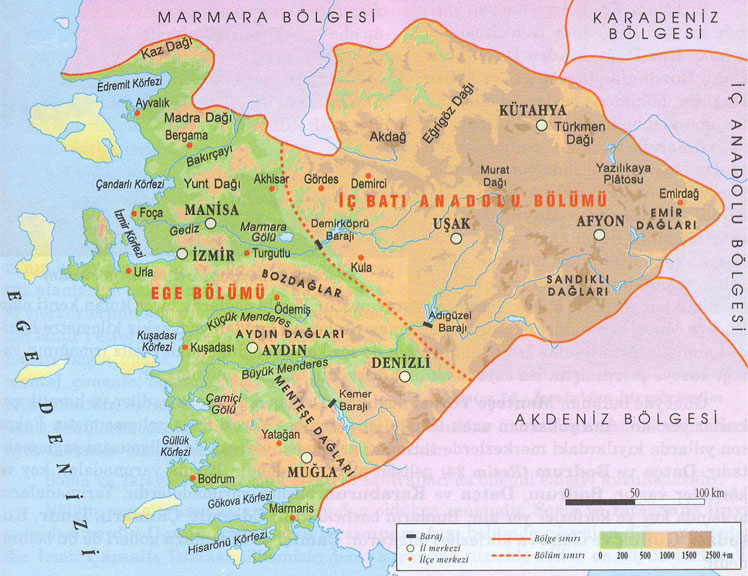
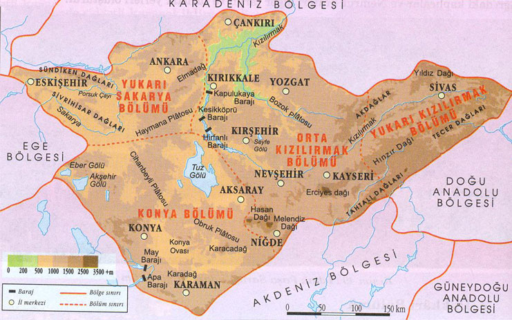
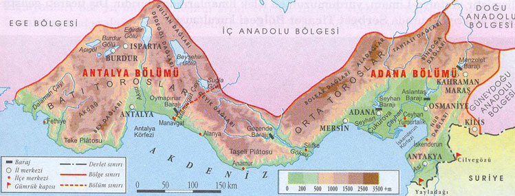
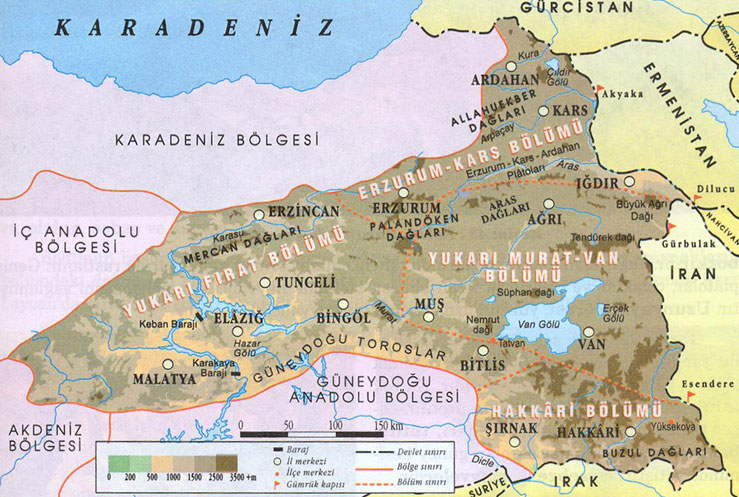
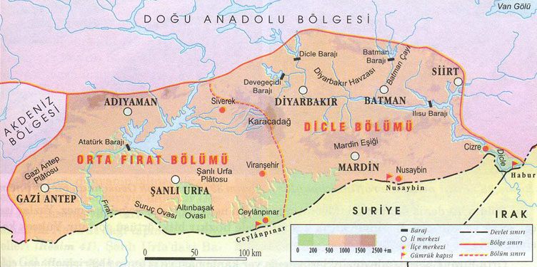
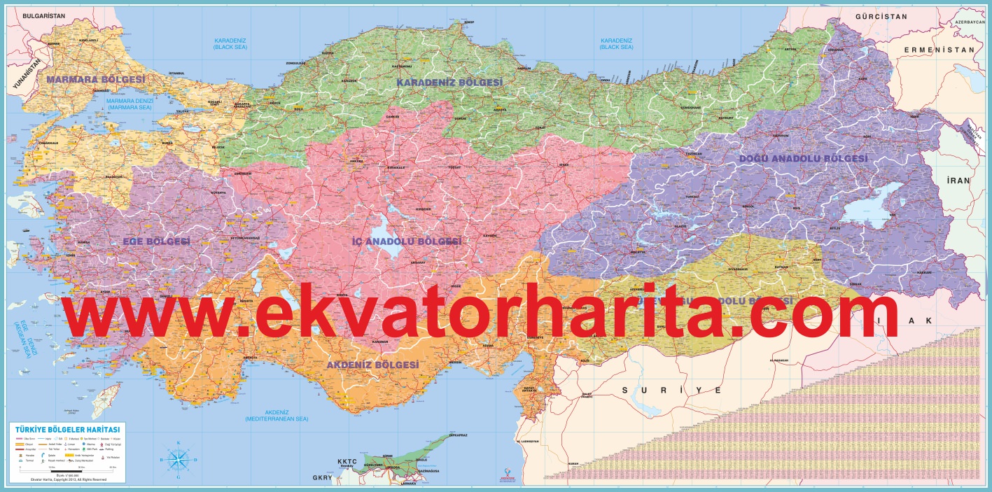
These maps are quite simply incorrect; the borders of the geographical regions of Turkey do not overlap with the borders of the administrative provinces.
This is the correct map of the geographical Aegean Region:
Provinces in the Aegean Region
editSince the borders do not overlap, there can be no clear-cut list of provinces in the Aegean Region.
Right now, this list is featured in the article:
Provinces in the Aegean Region
This list is also incorrect.
If we want to list the provinces in the Aegean Region, we will need at least two, but preferable three categorizies:
- Provinces that are entirely in the Aegean Region.
- Provinces that are mostly in the Aegean Region.
- Provinces that are partially in the Aegean Region.
According to this map, which shows both geographical and provincial borders, the correct list should be as follows:
Provinces in the Aegean Region
Provinces that are entirely in the Aegean Region:
Provinces that are mostly in the Aegean Region:
Provinces that are partially in the Aegean Region:
Population
editSince the geographical borders are imprecise (they don't overlap with district borders either), there is no convenient way to calculate the population of the geographical Aegean Region, or other geographical regions of Turkey for that matter. Any figure you see on the Internet in this regard is, at best, imprecise guesswork. I propose that we rank geographical regions among themselves and leave it at that. --Mttll (talk) 10:16, 20 January 2015 (UTC)
New infobox suggestion
editIt is actually meant to be used for countries, but I believe it serves its purpose very well here. Eagerly waiting for comments. --Mttll (talk) 15:48, 4 February 2015 (UTC)
| Continent | Eurasia |
|---|---|
| Region | Western Asia |
| Area | Ranked 5th |
| • Total | 93,139 km2 (35,961 sq mi) |
| Coastline | 2,600 km (1,600 mi) |
| Highest point | Mount Honaz (2,571 m) |
| Lowest point | Aegean Sea (0 m) |
| Longest river | Büyük Menderes (548 km) |
| Largest lake | Lake Bafa (298 km²) |
External links modified
editHello fellow Wikipedians,
I have just modified one external link on Aegean Region. Please take a moment to review my edit. If you have any questions, or need the bot to ignore the links, or the page altogether, please visit this simple FaQ for additional information. I made the following changes:
- Added archive https://web.archive.org/web/20110620035225/http://dmi.gov.tr/veridegerlendirme/il-ve-ilceler-istatistik.aspx?m=AYDIN to http://www.dmi.gov.tr/veridegerlendirme/il-ve-ilceler-istatistik.aspx?m=AYDIN
When you have finished reviewing my changes, you may follow the instructions on the template below to fix any issues with the URLs.
This message was posted before February 2018. After February 2018, "External links modified" talk page sections are no longer generated or monitored by InternetArchiveBot. No special action is required regarding these talk page notices, other than regular verification using the archive tool instructions below. Editors have permission to delete these "External links modified" talk page sections if they want to de-clutter talk pages, but see the RfC before doing mass systematic removals. This message is updated dynamically through the template {{source check}} (last update: 5 June 2024).
- If you have discovered URLs which were erroneously considered dead by the bot, you can report them with this tool.
- If you found an error with any archives or the URLs themselves, you can fix them with this tool.
Cheers.—InternetArchiveBot (Report bug) 11:08, 27 June 2017 (UTC)