The Tropical Cyclones Portal
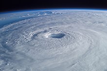
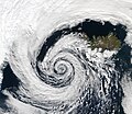
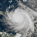
A tropical cyclone is a storm system characterized by a large low-pressure center, a closed low-level circulation and a spiral arrangement of numerous thunderstorms that produce strong winds and heavy rainfall. Tropical cyclones feed on the heat released when moist air rises, resulting in condensation of water vapor contained in the moist air. They are fueled by a different heat mechanism than other cyclonic windstorms such as Nor'easters, European windstorms and polar lows, leading to their classification as "warm core" storm systems. Most tropical cyclones originate in the doldrums, approximately ten degrees from the Equator.
The term "tropical" refers to both the geographic origin of these systems, which form almost exclusively in tropical regions of the globe, as well as to their formation in maritime tropical air masses. The term "cyclone" refers to such storms' cyclonic nature, with anticlockwise rotation in the Northern Hemisphere and clockwise rotation in the Southern Hemisphere. Depending on its location and intensity, a tropical cyclone may be referred to by names such as "hurricane", "typhoon", "tropical storm", "cyclonic storm", "tropical depression" or simply "cyclone".
Types of cyclone: 1. A "Typhoon" is a tropical cyclone located in the North-west Pacific Ocean which has the most cyclonic activity and storms occur year-round. 2. A "Hurricane" is also a tropical cyclone located at the North Atlantic Ocean or North-east Pacific Ocean which have an average storm activity and storms typically form between May 15 and November 30. 3. A "Cyclone" is a tropical cyclone that occurs in the South Pacific and Indian Oceans.
Selected named cyclone -
Typhoon Abby, known in the Philippines as Typhoon Diding, was an extremely powerful tropical cyclone which was the second typhoon to strike Japan within a span of a few days in August 1983. First noted southeast of Guam on July 31, development of this system was initially slow to occur; it was first classified on August 5, and was upgraded into a tropical storm the next day. Intensification was rapid as Abby slowly recurved northward on August 7 and 8. After reaching peak intensity with winds of 140 mph (225 km/h) early on August 9, Abby slowly weakened, though the storm briefly re-intensified on August 11. By August 14, winds had diminished to 100 mph (160 km/h). Abby finally weakened back into a tropical storm on August 17 not long after making landfall in Japan. The following day, Abby completed the transition to an extratropical cyclone after moving through central Japan. However, meteorologists continued monitoring the storm for six more days.
In the Philippines, heavy rainfall resulted in a landslide that crushed a house in Manila, killing three people. Two others drowned due to rough seas. Typhoon Abby also brought several consecutive days of rain to southern and central Japan, resulting in widespread damage. Commercial traffic by land, sea, and air was also paralyzed by the cyclone, stranding 25,900. Moreover, over 10,000 fishing boats took refuge in harbors. Around 3,400 homes were flooded and 24 homes were either damaged or destroyed. Additionally, 89 roads were also damaged. About a dozen people were injured during a flash flood that destroyed three houses. Three more dwellings were washed away when a river overflowed its banks. Nationwide, 27 people were hurt and two persons were killed. One person was listed as missing. (Full article...)Selected article -
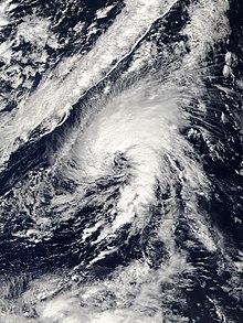
The 2005 Azores subtropical storm was the 19th nameable storm and only subtropical storm of the extremely active 2005 Atlantic hurricane season. It was not named by the National Hurricane Center as it was operationally classified as an extratropical low. It developed in the eastern Atlantic Ocean, an unusual region for late-season tropical cyclogenesis. Nonetheless, the system was able to generate a well-defined centre convecting around a warm core on 4 October. The system was short-lived, crossing over the Azores later on 4 October before becoming extratropical again on 5 October. No damages or fatalities were reported during that time. Its remnants were soon absorbed into a cold front. That system went on to become Hurricane Vince, which affected the Iberian Peninsula.
The subtropical nature of this unnamed system was determined several months after the fact, while the National Hurricane Center was performing its annual review of the season. Upon reclassification, the storm was entered into HURDAT, the official hurricane database. (Full article...)Selected image -

Selected season -

The 2019 North Indian Ocean cyclone season was the second most active North Indian Ocean cyclone season on record in terms of cyclonic storms, the 1992 season was more active according to the Joint Typhoon Warning Center. The season featured 12 depressions, 11 deep depressions, 8 cyclonic storms, 6 severe cyclonic storms, 6 very severe cyclonic storms, 3 extremely severe cyclonic storms, and 1 super cyclonic storm, Kyarr, the first since Cyclone Gonu in 2007. Additionally, it also became the third-costliest season recorded in the North Indian Ocean, only behind the 2020 and 2008 seasons.
The season's first named storm, Pabuk, entered the basin on January 4, becoming the earliest-forming cyclonic storm of the North Indian Ocean on record. The second cyclone of the season, Cyclone Fani, at the time was the strongest tropical cyclone in the Bay of Bengal by 3-minute maximum sustained wind speed until it got tied with Cyclone Mocha of 2023, and minimum barometric pressure since the 1999 Odisha cyclone, while being equal in terms of maximum 3-minute sustained wind speed to 2007's Sidr and 2013's Phailin. Further activity occurred in October, and in the latter part of that month, the first and only super cyclonic storm of the 2010s, Kyarr, formed. (Full article...)Related portals
Currently active tropical cyclones

Italicized basins are unofficial.
- North Atlantic (2024)
- No active systems
- East and Central Pacific (2024)
- No active systems
- North Indian Ocean (2024)
- No active systems
- Mediterranean (2023–24)
- No active systems
- South-West Indian Ocean (2023–24)
- No active systems
- Australian region (2023–24)
- No active systems
- South Pacific (2023–24)
- No active systems
- South Atlantic (2023–24)
- No active systems
Last updated: 00:02, 23 May 2024 (UTC)
Tropical cyclone anniversaries

- May 22, 1996 - Tropical Storm Cam (pictured) reached its peak intensity with 110 km/h (70 mph) while moving to the east through the Luzon Strait between the Philippines and Taiwan.

May 23
- 1976 - Subtropical Storm One struck the Florida Panhandle, bringing heavy rainfall to the southeastern United States but only minimal damage.
- 2003 - Typhoon Chan-hom (pictured) reaches its maximum intensity as a Category 4 typhoon with a pressure of 940 mbar (27.76 inHg).
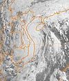
- May 24, 1989 - Tropical Storm Cecil (pictured) made landfall in central Vietnam where it killed 52 people and left over 100,000 others homeless.
Did you know…
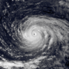


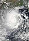
- …that the Joint Typhoon Warning Center considers that Typhoon Vera (pictured) of 1986 is actually two distinct systems, formed from two separated low-level circulations?
- …that Hurricane Agatha (pictured) was the strongest Pacific hurricane to make landfall in Mexico in May since records began in 1949?
- …that Cyclone Raquel (track pictured) travelled between the Australian and South Pacific basins between the 2014–15 and 2015–16 seasons, spanning both seasons in both basins?
- …that Cyclone Amphan (pictured) in 2020 was the first storm to be classified as a Super Cyclonic Storm in the Bay of Bengal since 1999?
General images -

Topics
Subcategories
Related WikiProjects
WikiProject Tropical cyclones is the central point of coordination for Wikipedia's coverage of tropical cyclones. Feel free to help!
WikiProject Weather is the main center point of coordination for Wikipedia's coverage of meteorology in general, and the parent project of WikiProject Tropical cyclones. Three other branches of WikiProject Weather in particular share significant overlaps with WikiProject Tropical cyclones:
- The Non-tropical storms task force coordinates most of Wikipedia's coverage on extratropical cyclones, which tropical cyclones often transition into near the end of their lifespan.
- The Floods task force takes on the scope of flooding events all over the world, with rainfall from tropical cyclones a significant factor in many of them.
- WikiProject Severe weather documents the effects of extreme weather such as tornadoes, which landfalling tropical cyclones can produce.
Things you can do
 |
Here are some tasks awaiting attention:
|
Wikimedia
The following Wikimedia Foundation sister projects provide more on this subject:
-
Commons
Free media repository -
Wikibooks
Free textbooks and manuals -
Wikidata
Free knowledge base -
Wikinews
Free-content news -
Wikiquote
Collection of quotations -
Wikisource
Free-content library -
Wikiversity
Free learning tools -
Wikivoyage
Free travel guide -
Wiktionary
Dictionary and thesaurus

